Western DataCom Announces MobileCom XE High Speed Cellular Modem for EV-DO/HSDPA Networks
location based services
MobileCom XE High Speed Cellular Modem for EV-DO/HSDPA NetworksWestern DataCom has designed a high speed digital 3G cellular modem for Evolution-Data Optimized (EV-DO) and High Speed Downlink Packet Access (HSDPA) based cellular networks. The MobileCom XE modem operates at carrier speeds that are currently available. For 1xEV-DO Rev.0 networks, throughput of this cellular modem is typically 1M bps and in HSDPA networks, modem throughputs are typically 500k bps. This cellular modem comes standard with GPS for navigation and location based services. The MobileCom XE has 10/100 based Ethernet and serial interfaces for easy installation and is packaged on a PC/104 board with available standalone or rackmount chassis. This modem will be upgradeable to 2xEV-DO and higher speed HSDPA networks when these higher speed networks are available from the cellular carriers.For more details, please contact Western DataCom by phone at 440-835-1510 or sales@western-data.com www.western-data.com
Source: Western DataCom Co., Inc.
Wednesday, September 27, 2006


Tuesday, September 26, 2006
Mobile Marketing Solutions
location based services
BLIP Systems offers a wide range of solutions for Mobile Marketing and Location Based Services.
BlipZones
BlipZones is the new & exciting Mobile Marketing Communication channel based on Bluetooth technology. The technology enables a targeted interaction with:
The right person, at the right time, in the right place and in the right context
BlipZones technology provides a high bandwidth & reliable marketing channel, with no costs for the end-user. It enables any company to distribute high bandwidth content such as pictures, sound and even video to registered or unregistered users.
Click here to find out more about BlipZones
BlipZones Modules
BlipZones technology consists of Basic module, Competition module and BlipExplorer. BlipZones Basic offers the possibility to send out rich media content to users with any Bluetooth mobile phone. Now the BlipZones software also includes device specific content delivery to mobiles, which provides an increased targeted communication with the user.
Furthermore, BlipZones can also run competitions or lottery campaigns. The competition module now provides the opportunity to run campaigns with a defined number of winners and the number of detection between them. Winner coupons can even uniquely watermarked.
The BlipExplorer is an application that the users accepts to receives. This can be targeted to the interests of the user or specific target groups and includes various opportunities for targeted specific content promoting a brand/organisation/event or product.
Click here to register for our free BlipZones webinar
location based services
BLIP Systems offers a wide range of solutions for Mobile Marketing and Location Based Services.
BlipZones
BlipZones is the new & exciting Mobile Marketing Communication channel based on Bluetooth technology. The technology enables a targeted interaction with:
The right person, at the right time, in the right place and in the right context
BlipZones technology provides a high bandwidth & reliable marketing channel, with no costs for the end-user. It enables any company to distribute high bandwidth content such as pictures, sound and even video to registered or unregistered users.
Click here to find out more about BlipZones
BlipZones Modules
BlipZones technology consists of Basic module, Competition module and BlipExplorer. BlipZones Basic offers the possibility to send out rich media content to users with any Bluetooth mobile phone. Now the BlipZones software also includes device specific content delivery to mobiles, which provides an increased targeted communication with the user.
Furthermore, BlipZones can also run competitions or lottery campaigns. The competition module now provides the opportunity to run campaigns with a defined number of winners and the number of detection between them. Winner coupons can even uniquely watermarked.
The BlipExplorer is an application that the users accepts to receives. This can be targeted to the interests of the user or specific target groups and includes various opportunities for targeted specific content promoting a brand/organisation/event or product.
Click here to register for our free BlipZones webinar
Nokia’s Big Music Day: Launches Smartphones, Song Service
location based services
At an event in New York today, Nokia introduced a couple of new Nseries handsets, updates to three existing models, and a new music recommendation service.
The world's top-selling mobile phone and smartphone vendor emphasized how multimedia is the fastest growing segment in the mobile space. For example, this year alone Nokia has sold over of 10 million of its high-end Nseries devices so far, and aims to sell 80 million music phones period before close of 2006.
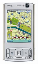
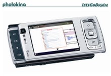
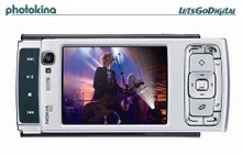
All-In-One N95First up on the menu is the new N95, which appears to include everything but the kitchen sink. As with all Nseries models, the device is built on the Symbian OS and S60 interface. It features a unique 2-way slider design that reveals media controls when moved one way and a keypad when moved the other.
When the N95 is in media mode, the 2.6-inch 240 x 320 pixel (QVGA) and 16 million color display is automatically placed into landscape mode. Built-in stereo speakers offer a 3D stereo effect, plus there's a standard 3.5 mm audio jack for headphones, a microSD slot for storage expansion, and mini USB for data transfers. Bluetooth with A2DP allows users to leverage wireless stereo headsets as well.
Users can record and playback VGA video at 30 fps with digital image stabilization. There's also TV out and support for MP3, AAC, M4A, and WMA audio files.
The N95 is also Nokia's first smartphone with a 5 megapixel digital camera for picture for video (the previous generation of Nseries models topped out at 3 megapixels) and integrated GPS for mapping and navigation. Tele Atlas provides the digital map data and dynamic location content handset, which includes free basic mapping and routing functionalities to initiate local searches for more than 100 countries and over 15 million points of interest.
There's also Wi-Fi, 160 MB of memory, and support for high speed HSDPA networks with the GSM/GPRS/EDGE/UTMS N95. As with all recent Nokia smartphones, including the N75 below, there's the new Nokia Web Browser with Mini Map for an improved Internet experience. We'll be publishing a detailed review of this browser in the near future.
The N95 weighs a mere 4.2 ounces (120 grams) and measures 4.0 x 2.0 x 0.7 inches (99 x 53 x 19 millimeters).
Nokia plans to ship the N95 during the first quarter of 2007 for about 550 Euros (about $702). It isn't clear if this model will make it stateside.
Compact N75A new smartphone that will definitely hit the U.S. market is the N75 clamshell, Nokia's smallest Nseries model yet - at 3.7 x 2.0 x 0.8 inches (95 x 52 x 20 millimeters) and 4.4 ounces (124 grams).
While the N75 and older N73, which has gotten a music-orientated makeover, are narrow, Nokia still has a way to go before reaching Motorola RAZR thinness of14 millimeters.
On the outside of the N75 is a small reflective 160 x 128 pixel resolution display and media controls for a music application. Inside, the 3G-enabled quad-band GPRS/EDGE/HTMS/HSDPA phone sports a 2.4-inch 240 x 320 pixel resolution (QVGA) screen that is capable of displaying 16 million different colors.
There's a 2 megapixel camera, micoSD slot, 40 MB of memory, FM radio, and Bluetooth 2.0 with support for wireless headsets. It can handle a variety of audio file formats and record and playback video at 15fps and a 352 x 288 resolution.
Nokia expects the N75 to become available during the fourth quarter of 2006 for an as-of-yet undisclosed price. No word on what American carrier will pick it up, although one in particular comes to mind - Cingular - as the most obvious.
Nokia Muscles Up with MusicThe trio of previously available Nseries models that got music makeovers includes the N91, N73 and N70, one of the original phones in the series. All three Music Edition versions of these smartphones, in what Nokia is calling the Nokia Nseries Music Range, now feature a Black chassis - the first noticeable difference. N73, N91, N70 Music Editions
There is also now additional software for easier synchronization and music management and more storage in all three models. For the N73 that means Nokia now bundles a 2 GB memory card and the N70 a 1 GB card.
Ah, but the N91 was a music phone already - a 4 GB smartphone in fact. What Nokia has done for that model is up its micro drive capacity to 8 GB. N91 Music Edition
Other than the aforementioned changes, the specs of the these devices stay pretty much the same as they've always been (see links below for details).
Nokia said the N70 Music Edition (350 Euros, about $447)and Nokia N73 Music Edition (450 Euros, about $574) should ship next monthly, while the Nokia N91 8GB (550 Euros, about $702) probably won't become available until later in the year. As with N95, there's no word yet on American availability.
Try This Song Today, came word that regulators approved Nokia's $60 million acquisition of music distributor Loudeye, which powers MSN and MTV's music stores, along with more than 60 other audio services. The Finnish phone maker also said it is working with forty leading independent music stores from around the world to launch a new music recommendation site on the Loudeye platform for later this fall- first in Britain and Australia. Called Music Recommenders, each of the 40 stores will offer a personalized selection of new music across 12 genres each month. Users can browse, search and listen to samples of the music, and then (of course) purchase it.
David Bowie will serve as the roll of 'godfather' to the whole enterprise, contributing his own recommendations as well as features and podcasts. "Waking up to a new sound or new band is something that makes my day just that bit more exciting," said Bowie. "Unfortunately, so much music goes unheard, especially things that don't bow to the mainstream. Music Recommenders help navigate the undiscovered music that is out there." He added, “I've actually been to some of the stores featured on Music Recommenders in various parts of the world, and found them to be a wonderful source for new and less traditional music."
Of course, Music Recommenders is only a prelude to Nokia's larger vision, competing with the likes of Apple's iTunes and Microsoft's upcoming Zune stores "We will launch a fully fledged comprehensive music service including devices and music purchase globally sometime in 2007," said Tapio Hedman, Nokia senior vice president for multimedia marketing, to Reuters.
location based services
At an event in New York today, Nokia introduced a couple of new Nseries handsets, updates to three existing models, and a new music recommendation service.
The world's top-selling mobile phone and smartphone vendor emphasized how multimedia is the fastest growing segment in the mobile space. For example, this year alone Nokia has sold over of 10 million of its high-end Nseries devices so far, and aims to sell 80 million music phones period before close of 2006.
All-In-One N95First up on the menu is the new N95, which appears to include everything but the kitchen sink. As with all Nseries models, the device is built on the Symbian OS and S60 interface. It features a unique 2-way slider design that reveals media controls when moved one way and a keypad when moved the other.
When the N95 is in media mode, the 2.6-inch 240 x 320 pixel (QVGA) and 16 million color display is automatically placed into landscape mode. Built-in stereo speakers offer a 3D stereo effect, plus there's a standard 3.5 mm audio jack for headphones, a microSD slot for storage expansion, and mini USB for data transfers. Bluetooth with A2DP allows users to leverage wireless stereo headsets as well.
Users can record and playback VGA video at 30 fps with digital image stabilization. There's also TV out and support for MP3, AAC, M4A, and WMA audio files.
The N95 is also Nokia's first smartphone with a 5 megapixel digital camera for picture for video (the previous generation of Nseries models topped out at 3 megapixels) and integrated GPS for mapping and navigation. Tele Atlas provides the digital map data and dynamic location content handset, which includes free basic mapping and routing functionalities to initiate local searches for more than 100 countries and over 15 million points of interest.
There's also Wi-Fi, 160 MB of memory, and support for high speed HSDPA networks with the GSM/GPRS/EDGE/UTMS N95. As with all recent Nokia smartphones, including the N75 below, there's the new Nokia Web Browser with Mini Map for an improved Internet experience. We'll be publishing a detailed review of this browser in the near future.
The N95 weighs a mere 4.2 ounces (120 grams) and measures 4.0 x 2.0 x 0.7 inches (99 x 53 x 19 millimeters).
Nokia plans to ship the N95 during the first quarter of 2007 for about 550 Euros (about $702). It isn't clear if this model will make it stateside.
Compact N75A new smartphone that will definitely hit the U.S. market is the N75 clamshell, Nokia's smallest Nseries model yet - at 3.7 x 2.0 x 0.8 inches (95 x 52 x 20 millimeters) and 4.4 ounces (124 grams).
While the N75 and older N73, which has gotten a music-orientated makeover, are narrow, Nokia still has a way to go before reaching Motorola RAZR thinness of14 millimeters.
On the outside of the N75 is a small reflective 160 x 128 pixel resolution display and media controls for a music application. Inside, the 3G-enabled quad-band GPRS/EDGE/HTMS/HSDPA phone sports a 2.4-inch 240 x 320 pixel resolution (QVGA) screen that is capable of displaying 16 million different colors.
There's a 2 megapixel camera, micoSD slot, 40 MB of memory, FM radio, and Bluetooth 2.0 with support for wireless headsets. It can handle a variety of audio file formats and record and playback video at 15fps and a 352 x 288 resolution.
Nokia expects the N75 to become available during the fourth quarter of 2006 for an as-of-yet undisclosed price. No word on what American carrier will pick it up, although one in particular comes to mind - Cingular - as the most obvious.
Nokia Muscles Up with MusicThe trio of previously available Nseries models that got music makeovers includes the N91, N73 and N70, one of the original phones in the series. All three Music Edition versions of these smartphones, in what Nokia is calling the Nokia Nseries Music Range, now feature a Black chassis - the first noticeable difference. N73, N91, N70 Music Editions
There is also now additional software for easier synchronization and music management and more storage in all three models. For the N73 that means Nokia now bundles a 2 GB memory card and the N70 a 1 GB card.
Ah, but the N91 was a music phone already - a 4 GB smartphone in fact. What Nokia has done for that model is up its micro drive capacity to 8 GB. N91 Music Edition
Other than the aforementioned changes, the specs of the these devices stay pretty much the same as they've always been (see links below for details).
Nokia said the N70 Music Edition (350 Euros, about $447)and Nokia N73 Music Edition (450 Euros, about $574) should ship next monthly, while the Nokia N91 8GB (550 Euros, about $702) probably won't become available until later in the year. As with N95, there's no word yet on American availability.
Try This Song Today, came word that regulators approved Nokia's $60 million acquisition of music distributor Loudeye, which powers MSN and MTV's music stores, along with more than 60 other audio services. The Finnish phone maker also said it is working with forty leading independent music stores from around the world to launch a new music recommendation site on the Loudeye platform for later this fall- first in Britain and Australia. Called Music Recommenders, each of the 40 stores will offer a personalized selection of new music across 12 genres each month. Users can browse, search and listen to samples of the music, and then (of course) purchase it.
David Bowie will serve as the roll of 'godfather' to the whole enterprise, contributing his own recommendations as well as features and podcasts. "Waking up to a new sound or new band is something that makes my day just that bit more exciting," said Bowie. "Unfortunately, so much music goes unheard, especially things that don't bow to the mainstream. Music Recommenders help navigate the undiscovered music that is out there." He added, “I've actually been to some of the stores featured on Music Recommenders in various parts of the world, and found them to be a wonderful source for new and less traditional music."
Of course, Music Recommenders is only a prelude to Nokia's larger vision, competing with the likes of Apple's iTunes and Microsoft's upcoming Zune stores "We will launch a fully fledged comprehensive music service including devices and music purchase globally sometime in 2007," said Tapio Hedman, Nokia senior vice president for multimedia marketing, to Reuters.
TECHNOLOGY TO HELP IMPROVE BUS SERVICES
location based services
Two trials using state-of-the-art technology will be conducted during the third school term as part of the current review of Tasmanian bus services.
The Minister for Infrastructure, Jim Cox, said today that the review had been told by people across Tasmania that bus services were not meeting the needs of communities.
“If our bus services are to better meet the needs of Tasmanian communities, better information is required on the use of buses,” Mr Cox said.
“During term three we will be undertaking two technology trials. One will involve free-to-the-user school buses and the other fare paying bus services.
“These trials are the first step in delivering modern and up-to-date bus services to regional Tasmania and will test the applicability of modern technology to the age-old problem of delivering better bus services and connecting Tasmanians living in rural and regional areas with their major population centres.”
The free-to-the-user school bus trial will be done in the Smithton area and will involve 11 buses fitted with technology which will be able to collect information on the bus used, route travelled, the time spent at stops, number of passengers carried and the location of boarding and disembarkation for passengers.
“During the trial, students using these bus services will not notice any difference in the service,” Mr Cox said.
“However, the trial is designed to enhance route planning and safety through the use of Global Positioning Systems, which will be able to track the buses on the route, and the collection of accurate passenger numbers at each stop.
The route bus service trial will be done on the Dodges Ferry/Sorell/ Hobart route and the West Tamar Launceston route. This trial will involve 20 buses fitted with technology which will be able to collect information on route travelled, time spent at stops, concession passengers carried, concession category validation and location of boarding and disembarkation for concession passengers.
The trial is designed to enhance route planning and safety through the use of Global Positioning Systems and to test smart card technology in relation to concession passenger journeys.
Students and other concession holders will be issued with a special ‘Go Card’ for the duration of the trial to identify their concession category. During the trial, this card will replace the current identification passengers use to access their concession fare.
It will be available on Manions Coaches in the North and Smith’s Surf to City buses in the South during the trial.
“We want to encourage users to be part of this trial, so every time the Go Card is used, the holder will be entered into a competition to win a return trip to Melbourne or an ipod Photo.
“With better information on passenger numbers, where passengers are getting on and off the bus and how well the bus is meeting its timetable, my Department will be better able to plan the future provision of bus services in areas around Tasmania that are experiencing rapid changes in population,” Mr Cox said.
location based services
Two trials using state-of-the-art technology will be conducted during the third school term as part of the current review of Tasmanian bus services.
The Minister for Infrastructure, Jim Cox, said today that the review had been told by people across Tasmania that bus services were not meeting the needs of communities.
“If our bus services are to better meet the needs of Tasmanian communities, better information is required on the use of buses,” Mr Cox said.
“During term three we will be undertaking two technology trials. One will involve free-to-the-user school buses and the other fare paying bus services.
“These trials are the first step in delivering modern and up-to-date bus services to regional Tasmania and will test the applicability of modern technology to the age-old problem of delivering better bus services and connecting Tasmanians living in rural and regional areas with their major population centres.”
The free-to-the-user school bus trial will be done in the Smithton area and will involve 11 buses fitted with technology which will be able to collect information on the bus used, route travelled, the time spent at stops, number of passengers carried and the location of boarding and disembarkation for passengers.
“During the trial, students using these bus services will not notice any difference in the service,” Mr Cox said.
“However, the trial is designed to enhance route planning and safety through the use of Global Positioning Systems, which will be able to track the buses on the route, and the collection of accurate passenger numbers at each stop.
The route bus service trial will be done on the Dodges Ferry/Sorell/ Hobart route and the West Tamar Launceston route. This trial will involve 20 buses fitted with technology which will be able to collect information on route travelled, time spent at stops, concession passengers carried, concession category validation and location of boarding and disembarkation for concession passengers.
The trial is designed to enhance route planning and safety through the use of Global Positioning Systems and to test smart card technology in relation to concession passenger journeys.
Students and other concession holders will be issued with a special ‘Go Card’ for the duration of the trial to identify their concession category. During the trial, this card will replace the current identification passengers use to access their concession fare.
It will be available on Manions Coaches in the North and Smith’s Surf to City buses in the South during the trial.
“We want to encourage users to be part of this trial, so every time the Go Card is used, the holder will be entered into a competition to win a return trip to Melbourne or an ipod Photo.
“With better information on passenger numbers, where passengers are getting on and off the bus and how well the bus is meeting its timetable, my Department will be better able to plan the future provision of bus services in areas around Tasmania that are experiencing rapid changes in population,” Mr Cox said.
The Mobile Community : Ultra Mobile Devices
location based services
I’ve been spending a lot of time learning about Ultra Mobile Computing. The question that I’m still working to address is “Where is the line that defines when a mobile devices becomes ultra mobile?” The two groups that know the most about Ultra Mobile are the Platform and the Software Teams here at Intel. The Intel platform team is all about the “what”. What it will look like. What you will do with it. What will be the interface. What is the market. And what problem will need to be addressed. Then my peers in the software group come into the scene and address the “how”. How it works. How software is developed for it. How software is optimized to mange battery life, network connecting and user input. This is where things get interesting. The Intel Developer Forum is in San Francisco this week. It is a huge event designed to give the world a glimpse into what Intel has been working to develop. I’m going to be attending specifically to learn more about Ultra Mobile devices, but also to meet the hardware and software developers that will work to make the devices most useful to the market. I’ve been working with the ultra mobile platform team to sync up their plans with the software teams plans so that when developers ask how to develop for the platform we can give them the technical information through the Mobile Developer Community.At IDF I’m hoping to learn and share what it takes to develop for the planned usage models. I’m very excited to see the reality of Ultra Mobile in action. There is going to be a session on Introduction to Ultra Mobile and another for in-car Ultra Mobile Computing. I want to see the example of using the device in the car, in the living room and on the street. I believe that Ultra Mobile devices can fill the gap between cell phones awkwardly connected to the internet and the limitation of using a laptop when you are walking around. I’ve also heard from the developers that they are excited about the potential of location based services. There is a whole new opportunity to build solutions that provide value by knowing exactly where you are. I’m hoping to see how Intel’s Ultra Mobile team addresses these challenges and give the platform the capability to know where it is. Developers are expressing interest for the Ultra Mobile devices. There is a lot of exciting about things happening with Ultra Mobile and Intel has some great things in the pipeline. After IDF I’m sure I’ll have a whole new list of the opportunities and limitation, but why wait? What do you see as the opportunity and limitation for Ultra Mobile devices?
Published Monday, September 25, 2006 4:56 PM by MAD\acterste
location based services
I’ve been spending a lot of time learning about Ultra Mobile Computing. The question that I’m still working to address is “Where is the line that defines when a mobile devices becomes ultra mobile?” The two groups that know the most about Ultra Mobile are the Platform and the Software Teams here at Intel. The Intel platform team is all about the “what”. What it will look like. What you will do with it. What will be the interface. What is the market. And what problem will need to be addressed. Then my peers in the software group come into the scene and address the “how”. How it works. How software is developed for it. How software is optimized to mange battery life, network connecting and user input. This is where things get interesting. The Intel Developer Forum is in San Francisco this week. It is a huge event designed to give the world a glimpse into what Intel has been working to develop. I’m going to be attending specifically to learn more about Ultra Mobile devices, but also to meet the hardware and software developers that will work to make the devices most useful to the market. I’ve been working with the ultra mobile platform team to sync up their plans with the software teams plans so that when developers ask how to develop for the platform we can give them the technical information through the Mobile Developer Community.At IDF I’m hoping to learn and share what it takes to develop for the planned usage models. I’m very excited to see the reality of Ultra Mobile in action. There is going to be a session on Introduction to Ultra Mobile and another for in-car Ultra Mobile Computing. I want to see the example of using the device in the car, in the living room and on the street. I believe that Ultra Mobile devices can fill the gap between cell phones awkwardly connected to the internet and the limitation of using a laptop when you are walking around. I’ve also heard from the developers that they are excited about the potential of location based services. There is a whole new opportunity to build solutions that provide value by knowing exactly where you are. I’m hoping to see how Intel’s Ultra Mobile team addresses these challenges and give the platform the capability to know where it is. Developers are expressing interest for the Ultra Mobile devices. There is a lot of exciting about things happening with Ultra Mobile and Intel has some great things in the pipeline. After IDF I’m sure I’ll have a whole new list of the opportunities and limitation, but why wait? What do you see as the opportunity and limitation for Ultra Mobile devices?
Published Monday, September 25, 2006 4:56 PM by MAD\acterste
AJAX Search API Playground
The Google AJAX Search API has a number of well documented samples and solutions including the Video Search Solution and the Map Search Control Solution. Both of these solutions are great additions to a blog.
This morning, I modified a blogger template to include both of these solutions, as well as a core search solution. Fell free to take what I have done here and apply it to your blog, modifiy to meet your needs, etc. Just follow these instructions:
Sign up for a Google Ajax Search API Key and capture the key. For my blog, I used a url of http://ajaxsearch.blogspot.com
Download my modified template.
Edit the &key= values in the template where the Google Maps API and Ajax Search API are loaded and replace with your API Key (your key will work for both APIs).
Edit your blogger template, and replace or merge yours with mine. Note, mine is based on minima black.
Once you have got this going in your blog, you can do a few cool things:
Its very easy to include a hyper link in a blog post that results in a search on the map. Just create a the hyperlink as a javascript url that calls doMapSearch('search-term');. e.g., if you look at the resulting element, in "Edit HTML" mode, it will look something like this: Sakana. Here is an example: Sakana
Embedding core center column search is just like map searching only the function is doCoreSearch(); Here is an example: Google
Embedding video search links is just like map searching only the function is doVideoSearch(); Here is an example: Jimi Hendrix
Play around with this and let me know what you think.
p.s. - If you are a TypePad user, check out http://ajaxsearch.typepad.com
The Google AJAX Search API has a number of well documented samples and solutions including the Video Search Solution and the Map Search Control Solution. Both of these solutions are great additions to a blog.
This morning, I modified a blogger template to include both of these solutions, as well as a core search solution. Fell free to take what I have done here and apply it to your blog, modifiy to meet your needs, etc. Just follow these instructions:
Sign up for a Google Ajax Search API Key and capture the key. For my blog, I used a url of http://ajaxsearch.blogspot.com
Download my modified template.
Edit the &key= values in the template where the Google Maps API and Ajax Search API are loaded and replace with your API Key (your key will work for both APIs).
Edit your blogger template, and replace or merge yours with mine. Note, mine is based on minima black.
Once you have got this going in your blog, you can do a few cool things:
Its very easy to include a hyper link in a blog post that results in a search on the map. Just create a the hyperlink as a javascript url that calls doMapSearch('search-term');. e.g., if you look at the resulting element, in "Edit HTML" mode, it will look something like this: Sakana. Here is an example: Sakana
Embedding core center column search is just like map searching only the function is doCoreSearch(); Here is an example: Google
Embedding video search links is just like map searching only the function is doVideoSearch(); Here is an example: Jimi Hendrix
Play around with this and let me know what you think.
p.s. - If you are a TypePad user, check out http://ajaxsearch.typepad.com
Pew Internet: Future of the Internet
survey of internet leaders, activists, and analysts shows that a majority agree with predictions that by 2020:
A low-cost global network will be thriving and creating new opportunities in a “flattening” world.
Humans will remain in charge of technology, even as more activity is automated and “smart agents” proliferate. However, a significant 42% of survey respondents were pessimistic about humans’ ability to control the technology in the future. This significant majority agreed that dangers and dependencies will grow beyond our ability to stay in charge of technology. This was one of the major surprises in the survey.
Virtual reality will be compelling enough to enhance worker productivity and also spawn new addiction problems.
Tech “refuseniks” will emerge as a cultural group characterized by their choice to live off the network. Some will do this as a benign way to limit information overload, while others will commit acts of violence and terror against technology-inspired change.
People will wittingly and unwittingly disclose more about themselves, gaining some benefits in the process even as they lose some privacy.
English will be a universal language of global communications, but other languages will not be displaced. Indeed, many felt other languages such as Mandarin, would grow in prominence. At the same time, there was strong dispute about those futuristic scenarios among notable numbers of 742 respondents to survey conducted by the Pew Internet & American Life Project and Elon University. Those who raised challenges believe that governments and corporations will not necessarily embrace policies that will allow the network to spread to under-served populations; that serious social inequalities will persist; and that “addiction” is an inappropriate notion to attach to people’s interest in virtual environments.
The experts and analysts also split evenly on a central question of whether the world will be a better place in 2020 due to the greater transparency of people and institutions afforded by the internet: 46% agreed that the benefits of greater transparency of organizations and individuals would outweigh the privacy costs and 49% disagreed.
View PDF of Report
survey of internet leaders, activists, and analysts shows that a majority agree with predictions that by 2020:
A low-cost global network will be thriving and creating new opportunities in a “flattening” world.
Humans will remain in charge of technology, even as more activity is automated and “smart agents” proliferate. However, a significant 42% of survey respondents were pessimistic about humans’ ability to control the technology in the future. This significant majority agreed that dangers and dependencies will grow beyond our ability to stay in charge of technology. This was one of the major surprises in the survey.
Virtual reality will be compelling enough to enhance worker productivity and also spawn new addiction problems.
Tech “refuseniks” will emerge as a cultural group characterized by their choice to live off the network. Some will do this as a benign way to limit information overload, while others will commit acts of violence and terror against technology-inspired change.
People will wittingly and unwittingly disclose more about themselves, gaining some benefits in the process even as they lose some privacy.
English will be a universal language of global communications, but other languages will not be displaced. Indeed, many felt other languages such as Mandarin, would grow in prominence. At the same time, there was strong dispute about those futuristic scenarios among notable numbers of 742 respondents to survey conducted by the Pew Internet & American Life Project and Elon University. Those who raised challenges believe that governments and corporations will not necessarily embrace policies that will allow the network to spread to under-served populations; that serious social inequalities will persist; and that “addiction” is an inappropriate notion to attach to people’s interest in virtual environments.
The experts and analysts also split evenly on a central question of whether the world will be a better place in 2020 due to the greater transparency of people and institutions afforded by the internet: 46% agreed that the benefits of greater transparency of organizations and individuals would outweigh the privacy costs and 49% disagreed.
View PDF of Report
Google AJAX Search API in Blogger
location based services
The Google AJAX Search API has a number of well documented samples and solutions including the Video Search Solution and the Map Search Control Solution. Both of these solutions are great additions to a blog.
This morning, I modified a blogger template to include both of these solutions, as well as a core search solution. Fell free to take what I have done here and apply it to your blog, modifiy to meet your needs, etc. Just follow these instructions:
Sign up for a Google Ajax Search API Key and capture the key. For my blog, I used a url of http://ajaxsearch.blogspot.com
Download my modified template.
Edit the &key= values in the template where the Google Maps API and Ajax Search API are loaded and replace with your API Key (your key will work for both APIs).
Edit your blogger template, and replace or merge yours with mine. Note, mine is based on minima black.
Once you have got this going in your blog, you can do a few cool things:
Its very easy to include a hyper link in a blog post that results in a search on the map. Just create a the hyperlink as a javascript url that calls doMapSearch('search-term');. e.g., if you look at the resulting element, in "Edit HTML" mode, it will look something like this: Sakana. Here is an example: Sakana
Embedding core center column search is just like map searching only the function is doCoreSearch(); Here is an example: Google
Embedding video search links is just like map searching only the function is doVideoSearch(); Here is an example: Jimi Hendrix
Play around with this and let me know what you think.
location based services
The Google AJAX Search API has a number of well documented samples and solutions including the Video Search Solution and the Map Search Control Solution. Both of these solutions are great additions to a blog.
This morning, I modified a blogger template to include both of these solutions, as well as a core search solution. Fell free to take what I have done here and apply it to your blog, modifiy to meet your needs, etc. Just follow these instructions:
Sign up for a Google Ajax Search API Key and capture the key. For my blog, I used a url of http://ajaxsearch.blogspot.com
Download my modified template.
Edit the &key= values in the template where the Google Maps API and Ajax Search API are loaded and replace with your API Key (your key will work for both APIs).
Edit your blogger template, and replace or merge yours with mine. Note, mine is based on minima black.
Once you have got this going in your blog, you can do a few cool things:
Its very easy to include a hyper link in a blog post that results in a search on the map. Just create a the hyperlink as a javascript url that calls doMapSearch('search-term');. e.g., if you look at the resulting element, in "Edit HTML" mode, it will look something like this: Sakana. Here is an example: Sakana
Embedding core center column search is just like map searching only the function is doCoreSearch(); Here is an example: Google
Embedding video search links is just like map searching only the function is doVideoSearch(); Here is an example: Jimi Hendrix
Play around with this and let me know what you think.
Monday, September 25, 2006
Make way for GPS bus
location based services
FOUR thousand buses will be fitted with satellite tracking technology to help them beat heavy Sydney traffic.
Transport Minister John Watkins today announced the $135 million scheme that will allow RTA traffic controllers to "green light'' buses stuck in traffic.
It will take three years to fit all 4000 private and government buses around the state.
The commitment follows successful trials of the GPS technology on buses between Hurstville and Miranda in Sydney's south.
Traffic controllers have been instructed to alter traffic light timings to help buses stick to timetables.
Government-owned Sydney Buses have a worse reliability record than CityRail, with many commuters ignoring bus stop timetables.
The onboard GPS systems will be linked directly to the RTA Traffic Management Centre at Redfern.
"The system will also be capable of providing real time running information displays both onboard and at major stops,'' Mr Watkins said.
The RTA would soon advertise for interest in the contract to install the devices on buses in Sydney, the Illawarra, the Hunter and Central Coast, he added.
Mr Watkins said the Miranda trials took place in the first of Sydney's 43 strategic bus corridors and were extended to the Liverpool to Bankstown route.
"Other bus priority measures along these corridors include 'B' bus-only traffic signals, queue jumps, new peak-hour bus lanes amd intersection improvements to speed up bus travel,'' Mr Watkins said.
Is this a great idea or does it leave car drivers in the lurch? Tell us via the feedback form below
location based services
FOUR thousand buses will be fitted with satellite tracking technology to help them beat heavy Sydney traffic.
Transport Minister John Watkins today announced the $135 million scheme that will allow RTA traffic controllers to "green light'' buses stuck in traffic.
It will take three years to fit all 4000 private and government buses around the state.
The commitment follows successful trials of the GPS technology on buses between Hurstville and Miranda in Sydney's south.
Traffic controllers have been instructed to alter traffic light timings to help buses stick to timetables.
Government-owned Sydney Buses have a worse reliability record than CityRail, with many commuters ignoring bus stop timetables.
The onboard GPS systems will be linked directly to the RTA Traffic Management Centre at Redfern.
"The system will also be capable of providing real time running information displays both onboard and at major stops,'' Mr Watkins said.
The RTA would soon advertise for interest in the contract to install the devices on buses in Sydney, the Illawarra, the Hunter and Central Coast, he added.
Mr Watkins said the Miranda trials took place in the first of Sydney's 43 strategic bus corridors and were extended to the Liverpool to Bankstown route.
"Other bus priority measures along these corridors include 'B' bus-only traffic signals, queue jumps, new peak-hour bus lanes amd intersection improvements to speed up bus travel,'' Mr Watkins said.
Is this a great idea or does it leave car drivers in the lurch? Tell us via the feedback form below
Networked GPS offered better traffic info - Network World
NetworkWorld.com
location based services
Networked GPS offered better traffic info
Cool Tools By Keith Shaw, Network World, 09/25/06
It's DemoFall 2006 time, and here are two cool product launches happening at this week's show in San Diego. Dash Navigation
Dash is a GPS device that includes an always-on network connection (through a combination of GSM/GPRS cellular and Wi-Fi) to provide up-to-date and relevant information to users in their cars. The network connectivity will offer better real-time traffic data, and allow for on-the-fly searches and automatic map update downloads.
Dash aims to address several problems with existing GPS devices - traffic information is often inaccurate; mapping updates are often never downloaded or too difficult to configure; and businesses and services often move or change. While most GPS devices can give turn-by-turn directions, most users want more than that - they want the best route given traffic conditions, the best services on the route, and realistic estimates on how long it will take to get to a destination.
While the system relies on traffic sensors to detect conditions, the network connection means one driver's Dash unit can become a traffic probe for others. If the system detects that a user is going slower than normal on a road (as defined by usage patterns), the system will alert other Dash units of possible slowdowns and provide for re-routing. The company says about 1,000 units within a metropolitan area would provide enough data for real-time updates, but even the "first person in the city" with a unit will be able to receive information from traffic sensors and other databases.
Dash is in beta testing in the San Francisco Bay Area, with a first-quarter 2007 launch scheduled for California, then a national consumer launch for next summer. Pricing has not been announced, but the company says it will be competitive with other high-end GPS devices. In addition to the base unit, a monthly service fee will be assessed to support database updates and real-time network connectivity.
NetworkWorld.com
location based services
Networked GPS offered better traffic info
Cool Tools By Keith Shaw, Network World, 09/25/06
It's DemoFall 2006 time, and here are two cool product launches happening at this week's show in San Diego. Dash Navigation
Dash is a GPS device that includes an always-on network connection (through a combination of GSM/GPRS cellular and Wi-Fi) to provide up-to-date and relevant information to users in their cars. The network connectivity will offer better real-time traffic data, and allow for on-the-fly searches and automatic map update downloads.
Dash aims to address several problems with existing GPS devices - traffic information is often inaccurate; mapping updates are often never downloaded or too difficult to configure; and businesses and services often move or change. While most GPS devices can give turn-by-turn directions, most users want more than that - they want the best route given traffic conditions, the best services on the route, and realistic estimates on how long it will take to get to a destination.
While the system relies on traffic sensors to detect conditions, the network connection means one driver's Dash unit can become a traffic probe for others. If the system detects that a user is going slower than normal on a road (as defined by usage patterns), the system will alert other Dash units of possible slowdowns and provide for re-routing. The company says about 1,000 units within a metropolitan area would provide enough data for real-time updates, but even the "first person in the city" with a unit will be able to receive information from traffic sensors and other databases.
Dash is in beta testing in the San Francisco Bay Area, with a first-quarter 2007 launch scheduled for California, then a national consumer launch for next summer. Pricing has not been announced, but the company says it will be competitive with other high-end GPS devices. In addition to the base unit, a monthly service fee will be assessed to support database updates and real-time network connectivity.
Personal Security and Identity Theft Expert Says GPS Tracking Will Curb the Rate of Laptop Computer
location based services
According to an authority in the field, recent news of the widespread loss of Commerce Department laptops since 2001—many assigned to the Census Bureau—illustrated the need for companies to turn to solutions such as GPS tracking, which will improve laptop computer security.
[USPRwire, Mon Sep 25 2006] News of the widespread loss of Commerce Department laptops since 2001—many assigned to the Census Bureau—has provided possible hints to explain the boom in identity theft seen these past few years, according to an authority in the field. Robert Siciliano, a personal security and identity theft expert, said the Commerce Department’s revelation of more than a thousand laptops lost, together with previously publicized research and the theft of laptops from other firms, illustrated the need for companies to turn to solutions such as GPS tracking to curb the rate of laptops being irretrievably stolen or lost. “When you lose more than a thousand laptops—many of them containing Census Bureau data—less-than-scrupulous individuals are bound to find the information useful,” said Siciliano, who provides consumer education solutions to Fortune 500 companies and their clients. “With Census Bureau data in hand, the identity thief’s puzzle is a particularly easy one to complete.” The Privacy Learning Institute recently featured Siciliano on its Web site. This year, he has discussed identity theft on CNBC’s “On the Money” multiple times, on NBC’s “Today Show,” and on FOX News. President of IDTheftSecurity.com, Siciliano is also author of “The Safety Minute: 01.” Siciliano advised organizations that use laptop computers to consider solutions from companies such as MyLaptopGPS (www.MyLaptopGPS.com), whose product of the same name not only tracks any stolen laptop worldwide via the Internet, but also silently removes important files once the machine is stolen—returning them to the rightful user while placing them out of the criminal’s reach. As reported by the Associated Press, officials at the Commerce Department have released figures showing the loss of more than 1,100 laptops since the year 2001. More than half, according to reports, had been assigned to the Census Bureau. According to Siciliano, the news was no surprise: • In May, the theft of a laptop from the Veterans Affairs Department jeopardized millions of U.S. veterans’ identities. A few months later, another laptop theft there put the personal information of additional veterans at risk. • In June, Hotels.com reported the loss of a company laptop containing the financial records of about 243,000 customers. • Also in June, Equifax Inc., one of the three major credit reporting companies, suffered the theft of a laptop computer containing identifying information on the company’s 2,500 U.S. employees. Research released in August by the Ponemon Institute LLC found that the frequency of laptop theft in the workplace is, in fact, high. Furthermore, findings from an October 2005 report by CREDANT Technologies indicated that as many as 90 percent of missing company laptops house sensitive data, with a large percentage of these being noncompliant with California SB 1386’s encryption data requirements. “Laptop security needs a revamp,” said Siciliano. “These machines are, apparently, difficult for organizations to track and keep. GPS and other technologies would go a long way in curbing the rate of laptop loss and theft.” ### Identity theft affects us all, which is why Robert Siciliano, president of IDTheftSecurity.com, makes it his mission to provide consumer education solutions on identity theft to Fortune 500 companies and their clients. A leader of personal safety and security seminars nationwide, Siciliano has been featured on CNN, MSNBC, Fox News, “The Suze Orman Show,” “ABC News with Sam Donaldson,” “The Montel Williams Show,” “Maury Povich,” “Sally Jesse Raphael,” and “The Howard Stern Show.” The media may reach Siciliano at 1 (888) SICILIANO (742-4542). Visit his Web site, www.IDTheftSecurity.com, or his blog, www.IDTheftSecurity.blogspot.com. Siciliano’s full contact information follows: Robert Siciliano Personal Security Expert PHONE: 888-SICILIANO (742-4542) FAX: 877-2-FAX-NOW (232-9669) E-MAIL: Robert@IDTheftSecurity.com http://www.idtheftsecurity.com/ The media are encouraged to get in touch with Siciliano directly. They may also contact: Brent W. Skinner, President STETrevisions PHONE: 617-875-4859 FAX: 866-663-6557 E-MAIL: BrentSkinner@STETrevisions.biz http://www.STETrevisions.biz
location based services
According to an authority in the field, recent news of the widespread loss of Commerce Department laptops since 2001—many assigned to the Census Bureau—illustrated the need for companies to turn to solutions such as GPS tracking, which will improve laptop computer security.
[USPRwire, Mon Sep 25 2006] News of the widespread loss of Commerce Department laptops since 2001—many assigned to the Census Bureau—has provided possible hints to explain the boom in identity theft seen these past few years, according to an authority in the field. Robert Siciliano, a personal security and identity theft expert, said the Commerce Department’s revelation of more than a thousand laptops lost, together with previously publicized research and the theft of laptops from other firms, illustrated the need for companies to turn to solutions such as GPS tracking to curb the rate of laptops being irretrievably stolen or lost. “When you lose more than a thousand laptops—many of them containing Census Bureau data—less-than-scrupulous individuals are bound to find the information useful,” said Siciliano, who provides consumer education solutions to Fortune 500 companies and their clients. “With Census Bureau data in hand, the identity thief’s puzzle is a particularly easy one to complete.” The Privacy Learning Institute recently featured Siciliano on its Web site. This year, he has discussed identity theft on CNBC’s “On the Money” multiple times, on NBC’s “Today Show,” and on FOX News. President of IDTheftSecurity.com, Siciliano is also author of “The Safety Minute: 01.” Siciliano advised organizations that use laptop computers to consider solutions from companies such as MyLaptopGPS (www.MyLaptopGPS.com), whose product of the same name not only tracks any stolen laptop worldwide via the Internet, but also silently removes important files once the machine is stolen—returning them to the rightful user while placing them out of the criminal’s reach. As reported by the Associated Press, officials at the Commerce Department have released figures showing the loss of more than 1,100 laptops since the year 2001. More than half, according to reports, had been assigned to the Census Bureau. According to Siciliano, the news was no surprise: • In May, the theft of a laptop from the Veterans Affairs Department jeopardized millions of U.S. veterans’ identities. A few months later, another laptop theft there put the personal information of additional veterans at risk. • In June, Hotels.com reported the loss of a company laptop containing the financial records of about 243,000 customers. • Also in June, Equifax Inc., one of the three major credit reporting companies, suffered the theft of a laptop computer containing identifying information on the company’s 2,500 U.S. employees. Research released in August by the Ponemon Institute LLC found that the frequency of laptop theft in the workplace is, in fact, high. Furthermore, findings from an October 2005 report by CREDANT Technologies indicated that as many as 90 percent of missing company laptops house sensitive data, with a large percentage of these being noncompliant with California SB 1386’s encryption data requirements. “Laptop security needs a revamp,” said Siciliano. “These machines are, apparently, difficult for organizations to track and keep. GPS and other technologies would go a long way in curbing the rate of laptop loss and theft.” ### Identity theft affects us all, which is why Robert Siciliano, president of IDTheftSecurity.com, makes it his mission to provide consumer education solutions on identity theft to Fortune 500 companies and their clients. A leader of personal safety and security seminars nationwide, Siciliano has been featured on CNN, MSNBC, Fox News, “The Suze Orman Show,” “ABC News with Sam Donaldson,” “The Montel Williams Show,” “Maury Povich,” “Sally Jesse Raphael,” and “The Howard Stern Show.” The media may reach Siciliano at 1 (888) SICILIANO (742-4542). Visit his Web site, www.IDTheftSecurity.com, or his blog, www.IDTheftSecurity.blogspot.com. Siciliano’s full contact information follows: Robert Siciliano Personal Security Expert PHONE: 888-SICILIANO (742-4542) FAX: 877-2-FAX-NOW (232-9669) E-MAIL: Robert@IDTheftSecurity.com http://www.idtheftsecurity.com/ The media are encouraged to get in touch with Siciliano directly. They may also contact: Brent W. Skinner, President STETrevisions PHONE: 617-875-4859 FAX: 866-663-6557 E-MAIL: BrentSkinner@STETrevisions.biz http://www.STETrevisions.biz
-->
True Wi-Fi-Cellular Convergence?
location based services
By Michael HickinsSeptember 25, 2006Cisco and Nokia are working together on a dual-mode device that will support a hand-off between Wi-Fi and cellular networks.
Dual-mode handsets in the enterprise would allow users to shift seamlessly from network to network without worrying about dropped calls or degraded speeds of data transmission.
Alan Cohen, senior director of mobility solutions for Cisco, told a panel here at Interop New York 2006 that the two companies are testing a handset that will give users the ability to stay connected even as they move, for instance, from their offices to the parking lot.
Cohen told internetnews.com that the devices are already in use internally and will be released to market within the next six to 12 months.
Dual-mode devices are already available by the boatload, but Cohen explained that the Cisco-Nokia iterations will include important features that have thus far kept enterprises from adopting dual-mode handsets.
These include call admission control, enhanced security and power-save features.
Call admission control prevents VoIP networks from becoming over-saturated, and improves quality of service.
Cohen said that this type of solution is already being pushed aggressively in Japan, where Cisco has a partnership with NTT DoCoMo.
One out of five cell phones produced in Japan next year will have dual-mode capabilities, he said.
But Cohen also noted that NTT is the exception among carriers, whom he blamed for inhibiting the development of this type of device.
"Carriers perceive it as lost minutes," he said.
That's because when users walk into their office buildings, their dual-mode devices would switch from the carriers' networks to an enterprise Wi-Fi or other wireless network.
Craig Mathias, principal of Farpoint Group, agreed that carriers see dual-mode devices as a threat.
But Mathias also told internetnews.com that while carriers are currently resisting dual-mode, they will ultimately come around to it because they do not have enough spectrum to meet all the demands of voice and data transmission.
"They have no choice, but they think they do [now]," he said.
However, not everyone is convinced that enterprises will adopt this solution all that quickly
Vanessa Alvarez, an analyst with the Yankee Group, said that enterprises will need to see a compelling value proposition in order to switch from their current handsets.
Handset manufacturers like Nokia "will have to take a vertical approach," she said.
Ben Guderian, vice president of market strategy for IP telephony solutions provider Spectralink, identified some of those vertical markets at an earlier session.
"Large retailers, manufacturing distribution centers, and health care are verticals that have a compelling need for mobility," he said.
Mathias said that the pairing of market leaders Cisco and Nokia will accelerate adoption.
Cisco had also been working with Motorola , but that relationship didn't come to fruition, noted Alvarez.
Mathias noted that a lack of standards is also inhibiting adoption of next-generation devices.
He said that IEEE standard 802.11n will be released by the middle of 2008.
Mathias said that "politics is playing a huge role. That's why it's taking so long to get a standard."
He noted, however, that the market is not waiting around.
Another organization, the WiFi Alliance, is issuing an interim standard next year, he said.
Mathias believes that IEEE standard will be backward-compatible with the interim standard.
Story Courtesy of internetnews
True Wi-Fi-Cellular Convergence?
location based services
By Michael HickinsSeptember 25, 2006Cisco and Nokia are working together on a dual-mode device that will support a hand-off between Wi-Fi and cellular networks.
Dual-mode handsets in the enterprise would allow users to shift seamlessly from network to network without worrying about dropped calls or degraded speeds of data transmission.
Alan Cohen, senior director of mobility solutions for Cisco, told a panel here at Interop New York 2006 that the two companies are testing a handset that will give users the ability to stay connected even as they move, for instance, from their offices to the parking lot.
Cohen told internetnews.com that the devices are already in use internally and will be released to market within the next six to 12 months.
Dual-mode devices are already available by the boatload, but Cohen explained that the Cisco-Nokia iterations will include important features that have thus far kept enterprises from adopting dual-mode handsets.
These include call admission control, enhanced security and power-save features.
Call admission control prevents VoIP networks from becoming over-saturated, and improves quality of service.
Cohen said that this type of solution is already being pushed aggressively in Japan, where Cisco has a partnership with NTT DoCoMo.
One out of five cell phones produced in Japan next year will have dual-mode capabilities, he said.
But Cohen also noted that NTT is the exception among carriers, whom he blamed for inhibiting the development of this type of device.
"Carriers perceive it as lost minutes," he said.
That's because when users walk into their office buildings, their dual-mode devices would switch from the carriers' networks to an enterprise Wi-Fi or other wireless network.
Craig Mathias, principal of Farpoint Group, agreed that carriers see dual-mode devices as a threat.
But Mathias also told internetnews.com that while carriers are currently resisting dual-mode, they will ultimately come around to it because they do not have enough spectrum to meet all the demands of voice and data transmission.
"They have no choice, but they think they do [now]," he said.
However, not everyone is convinced that enterprises will adopt this solution all that quickly
Vanessa Alvarez, an analyst with the Yankee Group, said that enterprises will need to see a compelling value proposition in order to switch from their current handsets.
Handset manufacturers like Nokia "will have to take a vertical approach," she said.
Ben Guderian, vice president of market strategy for IP telephony solutions provider Spectralink, identified some of those vertical markets at an earlier session.
"Large retailers, manufacturing distribution centers, and health care are verticals that have a compelling need for mobility," he said.
Mathias said that the pairing of market leaders Cisco and Nokia will accelerate adoption.
Cisco had also been working with Motorola , but that relationship didn't come to fruition, noted Alvarez.
Mathias noted that a lack of standards is also inhibiting adoption of next-generation devices.
He said that IEEE standard 802.11n will be released by the middle of 2008.
Mathias said that "politics is playing a huge role. That's why it's taking so long to get a standard."
He noted, however, that the market is not waiting around.
Another organization, the WiFi Alliance, is issuing an interim standard next year, he said.
Mathias believes that IEEE standard will be backward-compatible with the interim standard.
Story Courtesy of internetnews
MicroTRAKgps Turns Tripled Sales Into Home Run With New Personal Tracker Product Line
location based services
DALLAS, TX -- September 21, 2006 -- MicroTRAKgps, a subsidiary of The Tracking Corporation (PINKSHEETS: MIOK), a leading provider of Global Positioning Systems (GPS) and Radio Frequency Identification (RFID) wireless location services and products that track and recover valuable assets, today announced that the introduction of their new GPS portable personal product line is experiencing a successful launch and is generating strong interest in the retail market. Introduced in August by a leading retailer with nationwide stores and dominant catalog customer base, sales are exceeding original expectations. Response and demand from the security-conscience consumer during the first six weeks is evident by the tripling of unit orders from the retailer since their opening order. "Consumers are becoming more aware of GPS technology and how it can protect their most precious assets. We know there is a huge market for the new product, and this early success proves that our business plan to the retail/consumer market is a viable reoccurring revenue stream with high growth potential," says Peter Stamos, President of MicroTRAKgps. The Product which retails for under $500 is a small portable unit approximately the size of a cell phone used to track people or personal and mobile assets as all-terrain vehicles (ATVs), boats and jet skies. Jerry Grisaffi, CEO of The Tracking Corporation, says, "The versatility and mobility of the new product makes it a resourceful tool for tracking anything of value. MicroTRAKgps' first quarter 2007 will unveil an addition to the Personal Tracker product line and plans for market expansion." About The Tracking Corporation The Tracking Corporation, formerly known as MicroTRAK, Inc., is a leading provider of Global Positioning Systems (GPS) technology and products that utilize in-vehicle hardware and wireless location services. Based in Dallas, The Tracking Corporation has combined the ubiquitous coverage of GPS with the nationwide cellular network and 24/7 automated web and telephone accessibility to provide real-time wireless location and tracking, emergency assistance, stolen vehicle recovery and many other personal and fleet management services. The RFID division of the company specializes in end-to-end Radio Frequency Identification (RFID) integration solutions and hardware, RFID Reader Portals and warehouse management systems in the Food, Manufacturing, Logistics, Retail, Pharmaceutical and Healthcare industries. This division implements system deployments that track inventory, assets, and people. If you are interested in viewing additional information on The Tracking Corporation, please visit the website at: www.microtrakgps.com
location based services
DALLAS, TX -- September 21, 2006 -- MicroTRAKgps, a subsidiary of The Tracking Corporation (PINKSHEETS: MIOK), a leading provider of Global Positioning Systems (GPS) and Radio Frequency Identification (RFID) wireless location services and products that track and recover valuable assets, today announced that the introduction of their new GPS portable personal product line is experiencing a successful launch and is generating strong interest in the retail market. Introduced in August by a leading retailer with nationwide stores and dominant catalog customer base, sales are exceeding original expectations. Response and demand from the security-conscience consumer during the first six weeks is evident by the tripling of unit orders from the retailer since their opening order. "Consumers are becoming more aware of GPS technology and how it can protect their most precious assets. We know there is a huge market for the new product, and this early success proves that our business plan to the retail/consumer market is a viable reoccurring revenue stream with high growth potential," says Peter Stamos, President of MicroTRAKgps. The Product which retails for under $500 is a small portable unit approximately the size of a cell phone used to track people or personal and mobile assets as all-terrain vehicles (ATVs), boats and jet skies. Jerry Grisaffi, CEO of The Tracking Corporation, says, "The versatility and mobility of the new product makes it a resourceful tool for tracking anything of value. MicroTRAKgps' first quarter 2007 will unveil an addition to the Personal Tracker product line and plans for market expansion." About The Tracking Corporation The Tracking Corporation, formerly known as MicroTRAK, Inc., is a leading provider of Global Positioning Systems (GPS) technology and products that utilize in-vehicle hardware and wireless location services. Based in Dallas, The Tracking Corporation has combined the ubiquitous coverage of GPS with the nationwide cellular network and 24/7 automated web and telephone accessibility to provide real-time wireless location and tracking, emergency assistance, stolen vehicle recovery and many other personal and fleet management services. The RFID division of the company specializes in end-to-end Radio Frequency Identification (RFID) integration solutions and hardware, RFID Reader Portals and warehouse management systems in the Food, Manufacturing, Logistics, Retail, Pharmaceutical and Healthcare industries. This division implements system deployments that track inventory, assets, and people. If you are interested in viewing additional information on The Tracking Corporation, please visit the website at: www.microtrakgps.com
Sunday, September 24, 2006
Microsoft to Launch Global Advertising Services
location based services
Microsoft Corp. will announce the worldwide launch of Microsoft Digital Advertising Solutions at Advertising Week 2006. The move combines the company's set of global advertising products and services into a unified offering for advertisers. Microsoft Digital Advertising Solutions is designed to connect advertisers with their target audiences across such devices as PCs, Xbox video game systems, web-enabled mobile phones and personal digital assistants (PDAs).The company says Microsoft Digital Advertising Solutions offers advertisers the ability to reach more than 465 million consumers each month across the MSN network and millions more through Windows Live, Xbox Live and Office Online. Microsoft's advertising portfolio extends its reach across some of Microsoft's latest releases such as Live Search and Live Local Search, through relationships such as those with Facebook, and the acquisition of in-game advertising pioneer Massive Inc.For mobile devices such as Windows Mobile Pocket PC and Smartphones, the company plans to target users by sending interactive image or text ads right to their wireless devices. Also in the plans is the use of Microsoft TV IPTV Edition for telecommunications carriers and for cable operators looking to deliver differentiated TV services and experiences, including some new advertising options.
location based services
Microsoft Corp. will announce the worldwide launch of Microsoft Digital Advertising Solutions at Advertising Week 2006. The move combines the company's set of global advertising products and services into a unified offering for advertisers. Microsoft Digital Advertising Solutions is designed to connect advertisers with their target audiences across such devices as PCs, Xbox video game systems, web-enabled mobile phones and personal digital assistants (PDAs).The company says Microsoft Digital Advertising Solutions offers advertisers the ability to reach more than 465 million consumers each month across the MSN network and millions more through Windows Live, Xbox Live and Office Online. Microsoft's advertising portfolio extends its reach across some of Microsoft's latest releases such as Live Search and Live Local Search, through relationships such as those with Facebook, and the acquisition of in-game advertising pioneer Massive Inc.For mobile devices such as Windows Mobile Pocket PC and Smartphones, the company plans to target users by sending interactive image or text ads right to their wireless devices. Also in the plans is the use of Microsoft TV IPTV Edition for telecommunications carriers and for cable operators looking to deliver differentiated TV services and experiences, including some new advertising options.
Geography Markup Language (GML) WG
Working Groups -->
Geography Markup Language is an XML grammar written in XML Schema for the modelling, transport, and storage of geographic information. The key concepts used by Geography Markup Language (GML) to model the world are drawn from the OGC Abstract Specification (available online: http://www.opengeospatial.org/techno/abstract.htm.
GML provides a variety of kinds of objects for describing geography including features, coordinate reference systems, geometry, topology, time, units of measure and generalized values. A geographic feature is "an abstraction of a real world phenomenon; it is a geographic feature if it is associated with a location relative to the Earth”. So a digital representation of the real world can be thought of as a set of features. The state of a feature is defined by a set of properties, where each property can be thought of as a {name, type, value} triple. The number of properties a feature may have, together with their names and types, are determined by its type definition. Geographic features with geometry are those with properties that may be geometry-valued. A feature collection is a collection of features that can itself be regarded as a feature; as a consequence a feature collection has a feature type and thus may have distinct properties of its own, in addition to the features it contains.
Geographic features in GML include coverages and observations as subtypes.
A coverage is a sub-type of feature that has a coverage function with a spatial domain and a value set range of homogeneous 2 to n dimensional tuples. A coverage can represent one feature or a collection of features “to model and make visible spatial relationships between, and the spatial distribution of, earth phenomena.” An observation models the act of observing, often with a camera, a person or some form of instrument (“an act of recognizing and noting a fact or occurrence often involving measurement with instruments”). An observation is considered to be a GML feature with a time at which the observation took place, and with a value for the observation.
A reference system provides a scale of measurement for assigning values “to a location, time or other descriptive quantity or quality”.
A coordinate reference system consists of a set of coordinate system axes that is related to the earth through a datum that defines the size and shape of the earth. Geometries in GML indicate the coordinate reference system in which their measurements have been made. The “parent” geometry element of a geometric complex or geometric aggregate makes this indication for its constituent geometries.
A temporal reference system provides standard units for measuring time and describing temporal length or duration. Following ISO 8601, the Gregorian calendar with UTC is used in GML as the default temporal reference system.
A Units of Measure (UOM) dictionary provides definitions of numerical measures of physical quantities, such as length, temperature, and pressure, and of conversions between UOMs
location based services
Working Groups -->
Geography Markup Language is an XML grammar written in XML Schema for the modelling, transport, and storage of geographic information. The key concepts used by Geography Markup Language (GML) to model the world are drawn from the OGC Abstract Specification (available online: http://www.opengeospatial.org/techno/abstract.htm.
GML provides a variety of kinds of objects for describing geography including features, coordinate reference systems, geometry, topology, time, units of measure and generalized values. A geographic feature is "an abstraction of a real world phenomenon; it is a geographic feature if it is associated with a location relative to the Earth”. So a digital representation of the real world can be thought of as a set of features. The state of a feature is defined by a set of properties, where each property can be thought of as a {name, type, value} triple. The number of properties a feature may have, together with their names and types, are determined by its type definition. Geographic features with geometry are those with properties that may be geometry-valued. A feature collection is a collection of features that can itself be regarded as a feature; as a consequence a feature collection has a feature type and thus may have distinct properties of its own, in addition to the features it contains.
Geographic features in GML include coverages and observations as subtypes.
A coverage is a sub-type of feature that has a coverage function with a spatial domain and a value set range of homogeneous 2 to n dimensional tuples. A coverage can represent one feature or a collection of features “to model and make visible spatial relationships between, and the spatial distribution of, earth phenomena.” An observation models the act of observing, often with a camera, a person or some form of instrument (“an act of recognizing and noting a fact or occurrence often involving measurement with instruments”). An observation is considered to be a GML feature with a time at which the observation took place, and with a value for the observation.
A reference system provides a scale of measurement for assigning values “to a location, time or other descriptive quantity or quality”.
A coordinate reference system consists of a set of coordinate system axes that is related to the earth through a datum that defines the size and shape of the earth. Geometries in GML indicate the coordinate reference system in which their measurements have been made. The “parent” geometry element of a geometric complex or geometric aggregate makes this indication for its constituent geometries.
A temporal reference system provides standard units for measuring time and describing temporal length or duration. Following ISO 8601, the Gregorian calendar with UTC is used in GML as the default temporal reference system.
A Units of Measure (UOM) dictionary provides definitions of numerical measures of physical quantities, such as length, temperature, and pressure, and of conversions between UOMs
LoadMyTracks can now send tracks!
location based services
We've heard your requests and are happy to announce that we have added this feature to the latest versions of LoadMyTracks. This is, by far and away, the most requested feature for LoadMyTracks and we will be diligently working over the next few weeks to bring this feature to our other supported GPS devices (today it works on Magellan and Garmin devices). Thanks for all of the encouragement and good thoughts by our current and future users. Please continue to provide us with the great feedback that you have with previous versions.
LoadMyTracks is a utility that allows users of the Macintosh to upload and download track, route, and waypoint information from a variety of GPS receivers and turn make the data available as either GPX files or KML files (for use with Google Earth).
Recent versions of LoadMyTracks also support some extensions to the GPX schema (defined originally by Topografix) in order to add support for heart rate, cadence, and lap information which is not in the current 1.0 or 1.1 versions of GPX. As of version 027, we are now using version 1.1 (the most up to date version ) and we have used the extension capability in the definition to add some additional data using our GPXDATA schema. The schema is currently open for review, but is still in the testing phase. More detailed information will be made available as it solidifies, but XML-saavy people are welcome to look at the schema and comment to us using the bug report form.
Added in version 032 is support for Geocaching using LOC files or GPX files with the extensions from geocaching.com . Right now, device support is limited, but there should be recognition of Geocache symbols for Garmin devices and support for full geocaching behavior on Magellan devices that support geocaching.
For more information about GIS, GPS, spatial analysis, etc. please visit our sister site at Cartographica.com
location based services
We've heard your requests and are happy to announce that we have added this feature to the latest versions of LoadMyTracks. This is, by far and away, the most requested feature for LoadMyTracks and we will be diligently working over the next few weeks to bring this feature to our other supported GPS devices (today it works on Magellan and Garmin devices). Thanks for all of the encouragement and good thoughts by our current and future users. Please continue to provide us with the great feedback that you have with previous versions.
LoadMyTracks is a utility that allows users of the Macintosh to upload and download track, route, and waypoint information from a variety of GPS receivers and turn make the data available as either GPX files or KML files (for use with Google Earth).
Recent versions of LoadMyTracks also support some extensions to the GPX schema (defined originally by Topografix) in order to add support for heart rate, cadence, and lap information which is not in the current 1.0 or 1.1 versions of GPX. As of version 027, we are now using version 1.1 (the most up to date version ) and we have used the extension capability in the definition to add some additional data using our GPXDATA schema. The schema is currently open for review, but is still in the testing phase. More detailed information will be made available as it solidifies, but XML-saavy people are welcome to look at the schema and comment to us using the bug report form.
Added in version 032 is support for Geocaching using LOC files or GPX files with the extensions from geocaching.com . Right now, device support is limited, but there should be recognition of Geocache symbols for Garmin devices and support for full geocaching behavior on Magellan devices that support geocaching.
For more information about GIS, GPS, spatial analysis, etc. please visit our sister site at Cartographica.com
Dapple
Explore the earth
location based services
Dapple makes it easy to find and visualize massive quantities of geoscientific data available on the Internet.
View geoscience data, satellite imagery, remote sensing data, geology maps, geophysical data, and many other earth data sets of interest to geoscientists.
Save an earth view and share your view with colleagues.
Add new Geosoft DAP and WMS servers of interest.
View GeoTIFF files.
Explore the earth
location based services
Dapple makes it easy to find and visualize massive quantities of geoscientific data available on the Internet.
View geoscience data, satellite imagery, remote sensing data, geology maps, geophysical data, and many other earth data sets of interest to geoscientists.
Save an earth view and share your view with colleagues.
Add new Geosoft DAP and WMS servers of interest.
View GeoTIFF files.
Google Maps Mania: All Special Roundup Posts
location based services
Here is a collection of all special posts I've put together for various countries, cities and topics. It should help you find specific Google Maps mashups for various themes:Special Google Maps Mania Posts:Mapping your Photos, Travel Mashups, Music Maps, Google Maps in the News & Media - Part 2, Celebrity Maps, Zip Code Maps, Book Maps, Educational Uses of Google Maps, How Google uses Google Maps - Part 2, Google Maps Creation Tools & Resources (All 8 parts are linked here).Country/City Google Maps Mania Roundup Posts: Australia Part1, Part2 UK - Part1, Part2, Part3 France - Part1, Part2, Part3, New Zealand Part1, Part 2, Canada Part1, Part 2, Germany Part1, Part2, China, Russia Part1, Part2, Italy, Holland, Greece, Cambodia, Thailand, Qatar, Hong Kong, Shanghai, New York City
location based services
Here is a collection of all special posts I've put together for various countries, cities and topics. It should help you find specific Google Maps mashups for various themes:Special Google Maps Mania Posts:Mapping your Photos, Travel Mashups, Music Maps, Google Maps in the News & Media - Part 2, Celebrity Maps, Zip Code Maps, Book Maps, Educational Uses of Google Maps, How Google uses Google Maps - Part 2, Google Maps Creation Tools & Resources (All 8 parts are linked here).Country/City Google Maps Mania Roundup Posts: Australia Part1, Part2 UK - Part1, Part2, Part3 France - Part1, Part2, Part3, New Zealand Part1, Part 2, Canada Part1, Part 2, Germany Part1, Part2, China, Russia Part1, Part2, Italy, Holland, Greece, Cambodia, Thailand, Qatar, Hong Kong, Shanghai, New York City
Friday, September 22, 2006
Multimap Extends Mobile Offering
Multimap has partnered with convergent communications company 2ergo to further mobilise its range of business-to-business solutions. The tie-up will enable Multimap clients to offer their customers maps to their nearest outlets through mobile phones.Mapping and location-based services on company websites have grown rapidly in recent years, with customers being able to go on-line and rapidly find maps and other information about their nearest store. Through the deal with 2ergo, Multimap's clients will be able to take this one step further and deliver this information and more through mobile handsets - starting with the enhancements of Multimap’s SMS Storefinder and Map2Mobile products.When consumers visit a website to find and view a map for their nearest outlets, they will now have the option of clicking on a mobile icon and sending the map directly to their phone. In addition, consumers will be able to text a shortcode to locate their nearest outlet for a given product or service provider and receive a personalised map. This will be delivered through mobile location technology, which will match the handset's position to the nearest appropriate outlet - making it ideal for people on the move looking for fuel, loyalty card partners, wi-fi hotspots and more. "Offering people access to maps through their mobile phone will help to further enhance the customer experience with our clients' brands” says Multimap Chairman and Founder, Sean Phelan. "We see the mobile channel as a key part of our integrated mapping services, and we'll be working with 2ergo over the coming months to explore new product and service opportunities."For 2ergo, Joint CEO Barry Sharples adds: “2ergo has worked very closely with Multimap to understand their clients' needs in order to create an application set that makes life easier for them, removes costs from their businesses and can generate tangible additional revenue for both Multimap and their clients. In today's 24/7 environment, time is viewed as an ever-precious commodity and with brand loyalty on the decline, companies need to work harder and look at innovative solutions to retain customers and improve the customer experience. Map-to-mobile and location-based services offer people more choice and convenience - helping businesses to retain happy customers."
location based services
Multimap has partnered with convergent communications company 2ergo to further mobilise its range of business-to-business solutions. The tie-up will enable Multimap clients to offer their customers maps to their nearest outlets through mobile phones.Mapping and location-based services on company websites have grown rapidly in recent years, with customers being able to go on-line and rapidly find maps and other information about their nearest store. Through the deal with 2ergo, Multimap's clients will be able to take this one step further and deliver this information and more through mobile handsets - starting with the enhancements of Multimap’s SMS Storefinder and Map2Mobile products.When consumers visit a website to find and view a map for their nearest outlets, they will now have the option of clicking on a mobile icon and sending the map directly to their phone. In addition, consumers will be able to text a shortcode to locate their nearest outlet for a given product or service provider and receive a personalised map. This will be delivered through mobile location technology, which will match the handset's position to the nearest appropriate outlet - making it ideal for people on the move looking for fuel, loyalty card partners, wi-fi hotspots and more. "Offering people access to maps through their mobile phone will help to further enhance the customer experience with our clients' brands” says Multimap Chairman and Founder, Sean Phelan. "We see the mobile channel as a key part of our integrated mapping services, and we'll be working with 2ergo over the coming months to explore new product and service opportunities."For 2ergo, Joint CEO Barry Sharples adds: “2ergo has worked very closely with Multimap to understand their clients' needs in order to create an application set that makes life easier for them, removes costs from their businesses and can generate tangible additional revenue for both Multimap and their clients. In today's 24/7 environment, time is viewed as an ever-precious commodity and with brand loyalty on the decline, companies need to work harder and look at innovative solutions to retain customers and improve the customer experience. Map-to-mobile and location-based services offer people more choice and convenience - helping businesses to retain happy customers."
Subscribe to:
Posts (Atom)