Navigation new 3G killer app, In-Stat says
location based services
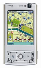
MUNICH, Germany — Market researcher In-Stat sees a surprising new killer application for 3G wireless to emerge: Mapping and navigation services.
While almost all industry pundits and applications experts for many years - and in vain - spread the gospel of imaging and video applications being the 3G killer application to come, In-Stat now bets on navigation and graphical display of location based services as the real killer application. However, wireless carriers willing to secure a piece of the market will have to expand the availability of compatible handsets, the market researchers point out.
"Expanding the number of Global Positioning Satellite (GPS) or Assisted-GPS (A-GPS) handsets from today's levels will be an important step for 3G carriers to provide the applications their customers really want," explains In-Stat analyst David Chamberlain. "Unfortunately, technology choices left over from the 1990s make this difficult but carriers and handset vendors are starting to provide an increasing flow of products that better meet the 3G customers' needs."
In a survey of more than 1,000 mobile users in North America, Europe, and Asia, the market researchers also found that presently the customer awareness of 3G is not very strong. More than 50 percent of the respondents did not even know if their carrier offers 3G services. But, on the other hand, almost 50 percent said they would consider changing their carrier in order to have access to 3G services.
Wednesday, October 11, 2006


Online map portal to launch mobile services
location based services
NEW DELHI: Online maps portal mapmyindia.com will soon launch location based services on mobile phone through various service providers. Rakesh Verma, MD, CE Infosystems which launched the 2007 version of its online maps portal mapmyindia.com here said "Along with its online customers, mobile users too can locate places across India". The website's new version uses the 2.0 web platform that provides a host of features including e-location, using which subscribers can save locations online to trace approach routes to them. "The new version brings online mapping closer to consumer expectations. We want to make the website accessible and practical," said Verma. The website can be accessed on GPRS enabled mobile phones. "We are talking to cellular service providers and are soon going to launch a service through them," informed Verma.
location based services
NEW DELHI: Online maps portal mapmyindia.com will soon launch location based services on mobile phone through various service providers. Rakesh Verma, MD, CE Infosystems which launched the 2007 version of its online maps portal mapmyindia.com here said "Along with its online customers, mobile users too can locate places across India". The website's new version uses the 2.0 web platform that provides a host of features including e-location, using which subscribers can save locations online to trace approach routes to them. "The new version brings online mapping closer to consumer expectations. We want to make the website accessible and practical," said Verma. The website can be accessed on GPRS enabled mobile phones. "We are talking to cellular service providers and are soon going to launch a service through them," informed Verma.
Verizon Wireless Customers Can Quickly Find What They Want And Get Recommendations With Free Get It Now Search
location based services
Verizon Wireless, the nation’s leading wireless service provider, announced today the availability of Get It Now® Search – a free application that allows Verizon Wireless customers with select Get It Now-enabled phones to quickly search across downloadable content available from VZW Games, VZW Tones and VZW Pix straight from their mobile phones. With Get It Now Search, customers can search by artist name, song title, game or application name to easily find the content they want. Once the results are presented, customers can purchase the content from their phones in just a few clicks and see recommendations of other content they may enjoy. In a first for the mobile search industry, Get It Now Search’s voice input option marks the first time customers can speak a search term instead of type it.
Using Get It Now Search, customers simply type – or speak – the search term directly into their phone. When the search is complete, the customer will be presented with search results including cost and description of the item available for purchase, followed by additional relevant information, such as a customer review. Get It Now Search also identifies other related content available through VZW Games, VZW Tones and VZW Pix that the customer may enjoy.
The new Get It Now Search from Verizon Wireless offers several features to help customers find what they want quickly and easily, including:
Voice Input – The Get It Now Search application utilizes voice recognition technology to help identify search terms customers speak into their phones
Text Input – Customers can use a traditional text search featuring auto-completion of partial inputs and spelling correction
Filtering – Customers will receive results that are compatible with their particular phone’s capabilities
Recommendation – Other relevant content of interest will be presented in the search result screen
Promotions – Within the search, customers will be notified of special promotions for featured services, artists and applications
Jim Straight, vice president of wireless Internet and multimedia for Verizon Wireless, said, “Get It Now Search helps our customers discover other relevant content across many categories, opening up a new world of mobile content with its easy search, discover and buy process. Using Get It Now Search, customers can easily find certain content within VZW Games, VZW Tones and VZW Pix, giving them what they want, when they want it, easier and faster than ever before.”
Get It Now Search is initially available on the LG VX4500, VX6100, VX8300, Chocolate (VX8500), The V (VX9800) and Motorola E815, RAZR V3c and RAZR V3m. There are no download charges for Get It Now Search, but airtime is required for use. The application is a featured application on Verizon Wireless’ Get It Now service on select phones. Download charges for Get It Now applications and content vary and airtime charges apply when browsing, downloading and using certain applications.
Verizon Wireless and Medio Systems, Inc., the technology provider for Get It Now Search, collaborated to develop this application specifically for Verizon Wireless customers.
For more information about Verizon Wireless products and services, visit a Verizon Wireless Communications Store, call 1-800-2 JOIN IN or go to www.verizonwireless.com.
About Verizon Wireless Verizon Wireless owns and operates the nation’s most reliable wireless network, serving 54.8 million voice and data customers. Headquartered in Basking Ridge, N.J., Verizon Wireless is a joint venture of Verizon Communications (NYSE:VZ) and Vodafone (NYSE and LSE: VOD). Find more information on the Web at www.verizonwireless.com. To preview and request broadcast-quality video footage and high-resolution stills of Verizon Wireless operations, log on to the Verizon Wireless Multimedia Library at www.verizonwireless.com/multimedia.
Get It Now is a registered trademark of Verizon Wireless.
» Read the press release at verizonwireless.com
» More Media Coverage
location based services
Verizon Wireless, the nation’s leading wireless service provider, announced today the availability of Get It Now® Search – a free application that allows Verizon Wireless customers with select Get It Now-enabled phones to quickly search across downloadable content available from VZW Games, VZW Tones and VZW Pix straight from their mobile phones. With Get It Now Search, customers can search by artist name, song title, game or application name to easily find the content they want. Once the results are presented, customers can purchase the content from their phones in just a few clicks and see recommendations of other content they may enjoy. In a first for the mobile search industry, Get It Now Search’s voice input option marks the first time customers can speak a search term instead of type it.
Using Get It Now Search, customers simply type – or speak – the search term directly into their phone. When the search is complete, the customer will be presented with search results including cost and description of the item available for purchase, followed by additional relevant information, such as a customer review. Get It Now Search also identifies other related content available through VZW Games, VZW Tones and VZW Pix that the customer may enjoy.
The new Get It Now Search from Verizon Wireless offers several features to help customers find what they want quickly and easily, including:
Voice Input – The Get It Now Search application utilizes voice recognition technology to help identify search terms customers speak into their phones
Text Input – Customers can use a traditional text search featuring auto-completion of partial inputs and spelling correction
Filtering – Customers will receive results that are compatible with their particular phone’s capabilities
Recommendation – Other relevant content of interest will be presented in the search result screen
Promotions – Within the search, customers will be notified of special promotions for featured services, artists and applications
Jim Straight, vice president of wireless Internet and multimedia for Verizon Wireless, said, “Get It Now Search helps our customers discover other relevant content across many categories, opening up a new world of mobile content with its easy search, discover and buy process. Using Get It Now Search, customers can easily find certain content within VZW Games, VZW Tones and VZW Pix, giving them what they want, when they want it, easier and faster than ever before.”
Get It Now Search is initially available on the LG VX4500, VX6100, VX8300, Chocolate (VX8500), The V (VX9800) and Motorola E815, RAZR V3c and RAZR V3m. There are no download charges for Get It Now Search, but airtime is required for use. The application is a featured application on Verizon Wireless’ Get It Now service on select phones. Download charges for Get It Now applications and content vary and airtime charges apply when browsing, downloading and using certain applications.
Verizon Wireless and Medio Systems, Inc., the technology provider for Get It Now Search, collaborated to develop this application specifically for Verizon Wireless customers.
For more information about Verizon Wireless products and services, visit a Verizon Wireless Communications Store, call 1-800-2 JOIN IN or go to www.verizonwireless.com.
About Verizon Wireless Verizon Wireless owns and operates the nation’s most reliable wireless network, serving 54.8 million voice and data customers. Headquartered in Basking Ridge, N.J., Verizon Wireless is a joint venture of Verizon Communications (NYSE:VZ) and Vodafone (NYSE and LSE: VOD). Find more information on the Web at www.verizonwireless.com. To preview and request broadcast-quality video footage and high-resolution stills of Verizon Wireless operations, log on to the Verizon Wireless Multimedia Library at www.verizonwireless.com/multimedia.
Get It Now is a registered trademark of Verizon Wireless.
» Read the press release at verizonwireless.com
» More Media Coverage
Microsoft and Pharos Introduce New GPS Locator for Microsoft Streets & Trips 2007 With GPS Locator
location based services
More powerful GPS receiver provides faster, more accurate location information for the best-selling travel and mapping software.(1)
REDMOND, Wash. and TORRANCE, Calif., Oct. 11 /PRNewswire-FirstCall/ -- Continuing their effort to provide complete and easy-to-use mapping information for customers around the globe, Microsoft Corp. and Pharos Science & Applications Inc. today unveiled a sleek new Global Positioning System (GPS) locator that will ship as part of Microsoft® Streets & Trips 2007 with GPS Locator, which is being launched today. Supplied by Pharos, the new SiRFstarIII GPS locator is more than 10 times more sensitive than the previous version. This improves the real-time navigation experience for Streets & Trips 2007 with GPS Locator customers whether they're in the city or mountains.
"Pharos has long been a leader in providing innovative navigation solutions for Microsoft products," said Helen Chiang, product manager for Streets & Trips at Microsoft. "The compact GPS receiver from Pharos combined with Microsoft's easy-to-use mapping software enables Streets & Trips customers to track their journey in real time and travel with complete confidence."
To use the new GPS locator, consumers can simply plug it into a notebook PC's USB port to view maps and travel routes in real time, so they always know where they are no matter where their travels take them. To use the GPS locator wirelessly, consumers can purchase a Bluetooth® dock or CompactFlash card adaptor directly from Pharos.
"With Streets & Trips 2007 with GPS Locator, Microsoft has developed a helpful, easy-to-use travel tool at a price within reach of everyday families," said James Oyang, Ph.D., president of Pharos. "We're pleased to provide a more sensitive GPS locator that will help expand the benefits of this powerful software."
Availability
Microsoft Streets & Trips 2007 with GPS Locator is available for an estimated retail price of $129 (U.S.).(2) Microsoft Streets & Trips 2007 Standard is available for an estimated retail price of $39.95 (U.S.).
About Pharos
Pharos is a leading provider of GPS navigation solutions and location based services (LBS) for mobile devices. The company is a charter member of Microsoft Mobility Partner Advisory Council, a Qualcomm BREW Developer, and a member of CTIA and ITS America. Pharos products are sold through a network of leading national retail locations and online stores including Amazon, Best Buy, Circuit City, CompUSA, DataVision, Dell, eXpansys, Fry's Electronics, J&R, Newwegg, RCS, Tech Depot and others. For more information, please visit www.pharosgps.com.
About Microsoft
Founded in 1975, Microsoft (Nasdaq: MSFT - News) is the worldwide leader in software, services and solutions that help people and businesses realize their full potential.
(1) Source: The NPD Group/NPD Techworld, March 1999-May 2006. Based on total U.S. retail sales.
(2) Actual retail price may vary.
Microsoft is a registered trademark of Microsoft Corp. in the United States and/or other countries.
Bluetooth is a trademark owned by the Bluetooth SIG Inc. and any use of such marks by Microsoft Corp. is under license.
The names of actual companies and products mentioned herein may be the trademarks of their respective owners.
For more information on Streets & Trips 2007:
http://www.microsoft.com/streets
Source: Microsoft Corp.
location based services
More powerful GPS receiver provides faster, more accurate location information for the best-selling travel and mapping software.(1)
REDMOND, Wash. and TORRANCE, Calif., Oct. 11 /PRNewswire-FirstCall/ -- Continuing their effort to provide complete and easy-to-use mapping information for customers around the globe, Microsoft Corp. and Pharos Science & Applications Inc. today unveiled a sleek new Global Positioning System (GPS) locator that will ship as part of Microsoft® Streets & Trips 2007 with GPS Locator, which is being launched today. Supplied by Pharos, the new SiRFstarIII GPS locator is more than 10 times more sensitive than the previous version. This improves the real-time navigation experience for Streets & Trips 2007 with GPS Locator customers whether they're in the city or mountains.
"Pharos has long been a leader in providing innovative navigation solutions for Microsoft products," said Helen Chiang, product manager for Streets & Trips at Microsoft. "The compact GPS receiver from Pharos combined with Microsoft's easy-to-use mapping software enables Streets & Trips customers to track their journey in real time and travel with complete confidence."
To use the new GPS locator, consumers can simply plug it into a notebook PC's USB port to view maps and travel routes in real time, so they always know where they are no matter where their travels take them. To use the GPS locator wirelessly, consumers can purchase a Bluetooth® dock or CompactFlash card adaptor directly from Pharos.
"With Streets & Trips 2007 with GPS Locator, Microsoft has developed a helpful, easy-to-use travel tool at a price within reach of everyday families," said James Oyang, Ph.D., president of Pharos. "We're pleased to provide a more sensitive GPS locator that will help expand the benefits of this powerful software."
Availability
Microsoft Streets & Trips 2007 with GPS Locator is available for an estimated retail price of $129 (U.S.).(2) Microsoft Streets & Trips 2007 Standard is available for an estimated retail price of $39.95 (U.S.).
About Pharos
Pharos is a leading provider of GPS navigation solutions and location based services (LBS) for mobile devices. The company is a charter member of Microsoft Mobility Partner Advisory Council, a Qualcomm BREW Developer, and a member of CTIA and ITS America. Pharos products are sold through a network of leading national retail locations and online stores including Amazon, Best Buy, Circuit City, CompUSA, DataVision, Dell, eXpansys, Fry's Electronics, J&R, Newwegg, RCS, Tech Depot and others. For more information, please visit www.pharosgps.com.
About Microsoft
Founded in 1975, Microsoft (Nasdaq: MSFT - News) is the worldwide leader in software, services and solutions that help people and businesses realize their full potential.
(1) Source: The NPD Group/NPD Techworld, March 1999-May 2006. Based on total U.S. retail sales.
(2) Actual retail price may vary.
Microsoft is a registered trademark of Microsoft Corp. in the United States and/or other countries.
Bluetooth is a trademark owned by the Bluetooth SIG Inc. and any use of such marks by Microsoft Corp. is under license.
The names of actual companies and products mentioned herein may be the trademarks of their respective owners.
For more information on Streets & Trips 2007:
http://www.microsoft.com/streets
Source: Microsoft Corp.
Facet Technology Corp. Announces New Web Service
location based services
Facet Technology Corp., the leading provider of precision street-level roadway imagery, is pleased to announce the release of its new Web service. The Web service provides for the delivery of Facet’s extensive inventory of georeferenced intersection and Point of Interest (POI) images to wireless devices. Facet’s existing inventory includes more than 1.5 billion images, with coverage of 2 million intersections and POIs. Facet currently serves the Portable Navigation Device (PND), smartphone, Personal Digital Assistant (PDA) and Location-based services (LBS) markets. Studies have shown that incorporating imagery into vehicle navigation creates a more effective, efficient and user preferred navigation environment. Facet is the clear market leader for intersection and POI content creation, with over 2 billion new images scheduled for collection in 2007. The W3C compliant Web service is engineered to require only minimal technical resources for implementation. A device sends a request, with a Lat/Lon or street address, for an intersection image or POI to the Web service via a wireless network. Facet Technology’s Web service returns the image or images requested from the inventory of geocoded imagery. Facet Technology is making sample imagery available through the Web service to wireless device manufacturers and application providers, for developmental purposes, at no cost. Interested parties are encouraged to contact Facet Technology.About Facet Technology Corp.Facet Technology Corp. is a leader in developing and delivering technology solutions for the efficient gathering and use of roadway information for infrastructure management and centerline base map creation. Facet developed and implemented SightMap®, a premium, next-generation geographic data solution that provides unparalleled accuracy and extensibility. A unique feature of SightMap® is its integrated database of fully georeferenced, panoramic street-level imagery.Contact Information:Facet Technology Corp.6517 City West ParkwayEden Prairie, MN 55344Web: www.facet-tech.comEmail: sales@facet-tech.com
Andrew Munyon (sales@facet-tech.com)Phone: 952.944.1839 x203
location based services
Facet Technology Corp., the leading provider of precision street-level roadway imagery, is pleased to announce the release of its new Web service. The Web service provides for the delivery of Facet’s extensive inventory of georeferenced intersection and Point of Interest (POI) images to wireless devices. Facet’s existing inventory includes more than 1.5 billion images, with coverage of 2 million intersections and POIs. Facet currently serves the Portable Navigation Device (PND), smartphone, Personal Digital Assistant (PDA) and Location-based services (LBS) markets. Studies have shown that incorporating imagery into vehicle navigation creates a more effective, efficient and user preferred navigation environment. Facet is the clear market leader for intersection and POI content creation, with over 2 billion new images scheduled for collection in 2007. The W3C compliant Web service is engineered to require only minimal technical resources for implementation. A device sends a request, with a Lat/Lon or street address, for an intersection image or POI to the Web service via a wireless network. Facet Technology’s Web service returns the image or images requested from the inventory of geocoded imagery. Facet Technology is making sample imagery available through the Web service to wireless device manufacturers and application providers, for developmental purposes, at no cost. Interested parties are encouraged to contact Facet Technology.About Facet Technology Corp.Facet Technology Corp. is a leader in developing and delivering technology solutions for the efficient gathering and use of roadway information for infrastructure management and centerline base map creation. Facet developed and implemented SightMap®, a premium, next-generation geographic data solution that provides unparalleled accuracy and extensibility. A unique feature of SightMap® is its integrated database of fully georeferenced, panoramic street-level imagery.Contact Information:Facet Technology Corp.6517 City West ParkwayEden Prairie, MN 55344Web: www.facet-tech.comEmail: sales@facet-tech.com
Andrew Munyon (sales@facet-tech.com)Phone: 952.944.1839 x203
Trimble VRS Now Service to Be Launched in Germany for High Precision GNSS Positioning
location based services
MUNICH, Germany, Oct. 10, 2006 -- Trimble (NASDAQ:TRMB) announced today it will launch its Trimble® VRS Now™ service for Germany in December. The commercial subscription service will provide surveyors, civil engineers and geospatial professionals with instant access to real-time kinematic (RTK) Global Navigation Satellite System (GNSS) corrections without the need for a base station. Using GNSS reference station data from SAPOS, the SAtellite POSitioning Service of the German State Survey, the Trimble service will deliver centimetre-level RTK positioning customized for each GNSS receivers exact location anywhere in the network. The Trimble VRS Now service will supply fast, easy to use and accurate GNSS positioning for a variety of applications including surveying, urban planning, construction, transportation, environmental monitoring, hydrography, agriculture, resource and territory management, disaster prevention and relief, weather services and scientific research.The announcement was made today at INTERGEO 2006, the worlds largest conference on geodesy, geoinformatics and land management.Volker Wegener, head of the Central Bureau SAPOS said, The Trimble VRS Now service is a prime example of SAPOS being an enabler to support commercial GNSS applications across the country. While SAPOS will maintain the accuracy and quality of the reference station network, we are delighted that Trimble will use their extensive expertise and resources to derive added value for new customers through the new Trimble VRS Now service. "Trimble VRS Now in Germany is the second commercial GNSS infrastructure service offering from Trimble and represents another milestone for our Connected Survey Site model," said Jürgen Kliem, general manager for Trimbles Survey Division. "Our goal is to streamline the work of surveying businesses and increase productivity by enhancing the synergies among tools, techniques, services and relationships, which build a Connected Survey Site."SAPOS uses Trimble VRS™ software to operate the majority of its GPS and GPS plus GLONASS networks, which cover approximately 357,045 square kilometers (136,415 square miles). Users will connect into the system using a wireless connection; the software acknowledges the users field positions and allows them to operate as though there is a reference station—a virtual reference station—right next to their rover. Utilizing Trimble VRS Now, surveyors and civil engineers can tap into centimeter-level RTK or differential GPS (DGPS) corrections anytime, anywhere within the VRS Now computed network. Trimble VRS Now represents a major advance in precision surveying productivity. No longer dependant on a field base station, precision GNSS surveys are easy to perform and users can be up and running in minutes. And without the need for base station hardware, the users GNSS receivers can now work independently as rovers—saving time and money. Simply connect, correct and measure.A subscription to Trimble VRS Now service and a GPS or GPS plus GLONASS rover is all a user needs to begin surveying or collecting data with precision. Surveyors and other users can switch on their receiver and real-time corrections will be available in seconds. Trimble VRS Now works with nearly all GPS and Global Navigation Satellite System (GNSS) survey instruments from a variety of manufacturers. For more information visit: www.trimble.com/VRSNow.shtml.The Connected Survey Site Trimble's Connected Survey Site model creates seamless working relationships among all Trimble products, technologies and services through support, infrastructure and partnerships. Taking Integrated Surveying™ to the next level, the Connected Survey Site enables surveyors to choose from a broad range of options; including surveying techniques, communications channels and facilitating services such as GNSS infrastructure in one fully-integrated and interoperable surveying solution. Surveyors benefit from complete data compatibility with all Trimble field and office software; increased flexibility in employing the best tools and techniques for the job at hand; the adaptation of specialized technologies to fit the ideal workflow of surveyors; and the localization of surveying solutions to address specific market needs throughout the world.About Trimble's Engineering and Construction BusinessTrimble, a world leader in GNSS, construction lasers, robotic total stations and machine control solutions, is creating a broad range of innovative solutions that changes the way construction work is done. The Engineering and Construction business of Trimble is focusing on the development of technology and solutions in the core areas of surveying, construction and infrastructure. From concept to completion, Trimble's integrated systems streamline jobs and improve productivity.About Trimble Trimble is a leading innovator of Global Navigation Satellite System (GNSS) technology. In addition to providing advanced GPS components, Trimble augments GPS with other positioning technologies as well as wireless communications and software to create complete customer solutions. Trimble's worldwide presence and unique capabilities position the Company for growth in emerging applications including surveying, agriculture, machine guidance, fleet and asset management, wireless platforms, and telecommunications infrastructure. Founded in 1978 and headquartered in Sunnyvale, Calif., Trimble has more than 2,400 employees in more than 18 countries worldwide.
location based services
MUNICH, Germany, Oct. 10, 2006 -- Trimble (NASDAQ:TRMB) announced today it will launch its Trimble® VRS Now™ service for Germany in December. The commercial subscription service will provide surveyors, civil engineers and geospatial professionals with instant access to real-time kinematic (RTK) Global Navigation Satellite System (GNSS) corrections without the need for a base station. Using GNSS reference station data from SAPOS, the SAtellite POSitioning Service of the German State Survey, the Trimble service will deliver centimetre-level RTK positioning customized for each GNSS receivers exact location anywhere in the network. The Trimble VRS Now service will supply fast, easy to use and accurate GNSS positioning for a variety of applications including surveying, urban planning, construction, transportation, environmental monitoring, hydrography, agriculture, resource and territory management, disaster prevention and relief, weather services and scientific research.The announcement was made today at INTERGEO 2006, the worlds largest conference on geodesy, geoinformatics and land management.Volker Wegener, head of the Central Bureau SAPOS said, The Trimble VRS Now service is a prime example of SAPOS being an enabler to support commercial GNSS applications across the country. While SAPOS will maintain the accuracy and quality of the reference station network, we are delighted that Trimble will use their extensive expertise and resources to derive added value for new customers through the new Trimble VRS Now service. "Trimble VRS Now in Germany is the second commercial GNSS infrastructure service offering from Trimble and represents another milestone for our Connected Survey Site model," said Jürgen Kliem, general manager for Trimbles Survey Division. "Our goal is to streamline the work of surveying businesses and increase productivity by enhancing the synergies among tools, techniques, services and relationships, which build a Connected Survey Site."SAPOS uses Trimble VRS™ software to operate the majority of its GPS and GPS plus GLONASS networks, which cover approximately 357,045 square kilometers (136,415 square miles). Users will connect into the system using a wireless connection; the software acknowledges the users field positions and allows them to operate as though there is a reference station—a virtual reference station—right next to their rover. Utilizing Trimble VRS Now, surveyors and civil engineers can tap into centimeter-level RTK or differential GPS (DGPS) corrections anytime, anywhere within the VRS Now computed network. Trimble VRS Now represents a major advance in precision surveying productivity. No longer dependant on a field base station, precision GNSS surveys are easy to perform and users can be up and running in minutes. And without the need for base station hardware, the users GNSS receivers can now work independently as rovers—saving time and money. Simply connect, correct and measure.A subscription to Trimble VRS Now service and a GPS or GPS plus GLONASS rover is all a user needs to begin surveying or collecting data with precision. Surveyors and other users can switch on their receiver and real-time corrections will be available in seconds. Trimble VRS Now works with nearly all GPS and Global Navigation Satellite System (GNSS) survey instruments from a variety of manufacturers. For more information visit: www.trimble.com/VRSNow.shtml.The Connected Survey Site Trimble's Connected Survey Site model creates seamless working relationships among all Trimble products, technologies and services through support, infrastructure and partnerships. Taking Integrated Surveying™ to the next level, the Connected Survey Site enables surveyors to choose from a broad range of options; including surveying techniques, communications channels and facilitating services such as GNSS infrastructure in one fully-integrated and interoperable surveying solution. Surveyors benefit from complete data compatibility with all Trimble field and office software; increased flexibility in employing the best tools and techniques for the job at hand; the adaptation of specialized technologies to fit the ideal workflow of surveyors; and the localization of surveying solutions to address specific market needs throughout the world.About Trimble's Engineering and Construction BusinessTrimble, a world leader in GNSS, construction lasers, robotic total stations and machine control solutions, is creating a broad range of innovative solutions that changes the way construction work is done. The Engineering and Construction business of Trimble is focusing on the development of technology and solutions in the core areas of surveying, construction and infrastructure. From concept to completion, Trimble's integrated systems streamline jobs and improve productivity.About Trimble Trimble is a leading innovator of Global Navigation Satellite System (GNSS) technology. In addition to providing advanced GPS components, Trimble augments GPS with other positioning technologies as well as wireless communications and software to create complete customer solutions. Trimble's worldwide presence and unique capabilities position the Company for growth in emerging applications including surveying, agriculture, machine guidance, fleet and asset management, wireless platforms, and telecommunications infrastructure. Founded in 1978 and headquartered in Sunnyvale, Calif., Trimble has more than 2,400 employees in more than 18 countries worldwide.
GPS coming to GSM handsets, analysts say
location based services
SAN FRANCISCO — After years of anticipation, global positioning system (GPS) technology should finally arrive in a significant number of GSM mobile handsets in 2007, according to a new study by market research analyst ABI Research. The report also concludes that 25 percent of WCDMA handsets will incorporate GPS by the end of 2008, ABI said Tuesday (Oct. 9).
Alan Varghese, ABI principal analyst, cites several factors for the expected rise of GPS in GSM and WCDMA handsets. Among these factors are government regulations covering location technology for emergency services—such as the FCC-mandated E911 in the U.S.—as well as a recognized demand for location-based services (LBS), according to Varghese.
"The CDMA carriers who have had GPS integrated in their handsets since 2002 have been turning on location based services over the past year," Varghese said.
Varghese also cited economic incentives, as carriers continue to look for ways to increase data revenue per subscriber and recoup high licensing costs for 3G spectrum.
In a research note published Monday, analyst Satya Chillara of Pacific Growth Equities LLC (San Francisco), said he believes GPS technology is at the beginning stages of being embedded into GSM-based cell phones. The new Nokia N95 phone utilizes GPS technology from Texas Instruments Inc., Chillara said.
A spokesperson for GSM operator Cingular Wireless told EE Times Monday that the company has made available turn-by-turn navigation services for business customers on some high-end PDAs. The spokesperson said the company plans to roll out LBS on a wider basis by mid-2007. "You will see more and more devices with GPS built in," the spokesperson said.
ABI said it sees 2007 as the year the GSM carriers will issue requests for qualifications and vendor selection and IC integration for the handset OEMs will take place. By the end of 2008, a quarter of all 3G handsets will have GPS ICs included, and the average selling price of a GPS chipset will have dropped to $2.70, ABI said.
"Sirf [Technology Holdings Inc.] has been the leader in the GPS IC space for the last several years," Varghese said through a statement. "But in the mobile phone segment, Atmel/u-blox, Global Locate, GloNav, Nemerix, Texas Instruments, and u-Nav will soon be nipping at their heels."
Analyst Will Strauss, president of Forward Concepts (Tempe, Ariz.) described a more cautious outlook for the growth of GPS in GSM handsets. "What we are finding is [outside of CDMA handsets] it's mostly high-end phones and low-end 'child find' kind of phones," Strauss told EE Times. "The big rollout that we see is mostly in the high-end WCDMA phones" which carry higher price points and can shoulder the extra cost, Strauss said.
Last year, Strauss said, there were 48 million cell phone-specific GPS chipsets shipped, a relatively small quantity considering there were 830 million cell phones shipped.
ABI is now offering its complete new study, "GPS Semiconductors," through the company's Web site. Forward Concepts has been offering a 460-page study called "Cellular Chip Markets" since July
location based services
SAN FRANCISCO — After years of anticipation, global positioning system (GPS) technology should finally arrive in a significant number of GSM mobile handsets in 2007, according to a new study by market research analyst ABI Research. The report also concludes that 25 percent of WCDMA handsets will incorporate GPS by the end of 2008, ABI said Tuesday (Oct. 9).
Alan Varghese, ABI principal analyst, cites several factors for the expected rise of GPS in GSM and WCDMA handsets. Among these factors are government regulations covering location technology for emergency services—such as the FCC-mandated E911 in the U.S.—as well as a recognized demand for location-based services (LBS), according to Varghese.
"The CDMA carriers who have had GPS integrated in their handsets since 2002 have been turning on location based services over the past year," Varghese said.
Varghese also cited economic incentives, as carriers continue to look for ways to increase data revenue per subscriber and recoup high licensing costs for 3G spectrum.
In a research note published Monday, analyst Satya Chillara of Pacific Growth Equities LLC (San Francisco), said he believes GPS technology is at the beginning stages of being embedded into GSM-based cell phones. The new Nokia N95 phone utilizes GPS technology from Texas Instruments Inc., Chillara said.
A spokesperson for GSM operator Cingular Wireless told EE Times Monday that the company has made available turn-by-turn navigation services for business customers on some high-end PDAs. The spokesperson said the company plans to roll out LBS on a wider basis by mid-2007. "You will see more and more devices with GPS built in," the spokesperson said.
ABI said it sees 2007 as the year the GSM carriers will issue requests for qualifications and vendor selection and IC integration for the handset OEMs will take place. By the end of 2008, a quarter of all 3G handsets will have GPS ICs included, and the average selling price of a GPS chipset will have dropped to $2.70, ABI said.
"Sirf [Technology Holdings Inc.] has been the leader in the GPS IC space for the last several years," Varghese said through a statement. "But in the mobile phone segment, Atmel/u-blox, Global Locate, GloNav, Nemerix, Texas Instruments, and u-Nav will soon be nipping at their heels."
Analyst Will Strauss, president of Forward Concepts (Tempe, Ariz.) described a more cautious outlook for the growth of GPS in GSM handsets. "What we are finding is [outside of CDMA handsets] it's mostly high-end phones and low-end 'child find' kind of phones," Strauss told EE Times. "The big rollout that we see is mostly in the high-end WCDMA phones" which carry higher price points and can shoulder the extra cost, Strauss said.
Last year, Strauss said, there were 48 million cell phone-specific GPS chipsets shipped, a relatively small quantity considering there were 830 million cell phones shipped.
ABI is now offering its complete new study, "GPS Semiconductors," through the company's Web site. Forward Concepts has been offering a 460-page study called "Cellular Chip Markets" since July
Mexens Technology unveils virtual GPS
location based services
Location technology firm Mexens Technology has unveiled a software application which it claims can place a virtual global positioning system (GPS) in almost any computerised device.Mexens' Navizon API allows businesses with an online presence to install software in a web-based application which triangulates the signals from surrounding Wi-Fi access points.The application identifies the exact location of the end user in order to deliver targeted, location-based content.
Mexens believes that software developers will be able to use the Navizon positioning engine in their own mobile applications, making it 'location aware' even on standard devices not equipped with GPS.The virtual GPS device could be used by high street chains to indicate their closest point of presence, or allow travellers to locate themselves on a laptop and find their way to their next destination.Mexens also suggested that security and payment processing companies could deploy the technology as an extra layer of protection against fraud.
location based services
Location technology firm Mexens Technology has unveiled a software application which it claims can place a virtual global positioning system (GPS) in almost any computerised device.Mexens' Navizon API allows businesses with an online presence to install software in a web-based application which triangulates the signals from surrounding Wi-Fi access points.The application identifies the exact location of the end user in order to deliver targeted, location-based content.
Mexens believes that software developers will be able to use the Navizon positioning engine in their own mobile applications, making it 'location aware' even on standard devices not equipped with GPS.The virtual GPS device could be used by high street chains to indicate their closest point of presence, or allow travellers to locate themselves on a laptop and find their way to their next destination.Mexens also suggested that security and payment processing companies could deploy the technology as an extra layer of protection against fraud.
Google Maps in the business world
location based services
Google Maps mashups have gone from fun-to-play-with hacks to intricate web applications known as mashups. This is thanks to the introduction of the Google Maps API and support from Google engineering staff and product management teams. As it appears clear that Google Maps is here to stay many companies are either partnering with Google or enlisting the help of Google Maps for Enterprise to uncover new business applications for these web-based maps and mashups. Here is a roundup of these recent partnerships, new business related maps mashups and further analysis and commentary from the news world and blogosphere..Business Maps Mashups:U.S. Cellular uses Google Maps in promotion [via]Patagonia.com Store FinderBritish Airways integrates mashes up with Google Maps - Watch and read this interview with the CIO of British Airways to understand BA's thinking behind this strategic partnership.Silicon Valley VC Funding Map (More VC Maps here)Whole Foods Store Finder - A map locator by Whole Foods Market. More info from this Google Enterprise Blog post.SalesForce.com: Improved Salesforce-Google Maps Mashup (Official SalesForce Blog - Aug.31/06)SalesForce.com: PPartner Recruitment Mash Up with Google Maps (Official SalesForce Blog - Mar.07/06)Other examples: Heineken, Jeep, MTV, Nike, Fidelity Investments, Big Media (More Business Maps Mashups are here..)Build a Business Maps Mashup:Google Maps for Enterprise - The Google Maps API with full enterprise licensing and supportBlipstar - This site lets you easily add a store or branch finder to your business websiteFreeDemographics.com API - Demographic information for your mashup = A Dashup. More info here.Add your business to Google Maps for free:Add your business to Google Maps (Google.com)Add Coupons to your Google Maps business listing (Google.com)Have Your Company Listed Free in Google Maps (ISED Sept.13/06)Google Intuit Partnership:The new version of QuickBooks will allow you to add a business listing and sell items on Google Maps. Check out what this might mean to businesses:Google Marketing Tools - (From Intuit.com)QuickBooks Premier Edition 2007 (ABCNews - Oct.4/06)The Google-Intuit Partnership: This Could Be Massive (Business 2.0 Blog - Sep.13/06)Major Google/Intuit Partnership (TechCrunch.com - Sep.13/06)Intuit & Google Announce Major Local Search Marketing Partnership (SearchEngineWatch - Sep.13/06)Cisco searches for Google link (Australian IT Oct.3/06) - "The networking giant said it was tinkering with Google's popular consumer focused services, including Google Maps, to see if they could be integrated with Cisco's unified internet protocol communications platform."Have I missed any high-profile companies making use of Google Maps? Do you know of an example where Google Maps for Enterprise is in use? If so, please post a comment.
location based services
Google Maps mashups have gone from fun-to-play-with hacks to intricate web applications known as mashups. This is thanks to the introduction of the Google Maps API and support from Google engineering staff and product management teams. As it appears clear that Google Maps is here to stay many companies are either partnering with Google or enlisting the help of Google Maps for Enterprise to uncover new business applications for these web-based maps and mashups. Here is a roundup of these recent partnerships, new business related maps mashups and further analysis and commentary from the news world and blogosphere..Business Maps Mashups:U.S. Cellular uses Google Maps in promotion [via]Patagonia.com Store FinderBritish Airways integrates mashes up with Google Maps - Watch and read this interview with the CIO of British Airways to understand BA's thinking behind this strategic partnership.Silicon Valley VC Funding Map (More VC Maps here)Whole Foods Store Finder - A map locator by Whole Foods Market. More info from this Google Enterprise Blog post.SalesForce.com: Improved Salesforce-Google Maps Mashup (Official SalesForce Blog - Aug.31/06)SalesForce.com: PPartner Recruitment Mash Up with Google Maps (Official SalesForce Blog - Mar.07/06)Other examples: Heineken, Jeep, MTV, Nike, Fidelity Investments, Big Media (More Business Maps Mashups are here..)Build a Business Maps Mashup:Google Maps for Enterprise - The Google Maps API with full enterprise licensing and supportBlipstar - This site lets you easily add a store or branch finder to your business websiteFreeDemographics.com API - Demographic information for your mashup = A Dashup. More info here.Add your business to Google Maps for free:Add your business to Google Maps (Google.com)Add Coupons to your Google Maps business listing (Google.com)Have Your Company Listed Free in Google Maps (ISED Sept.13/06)Google Intuit Partnership:The new version of QuickBooks will allow you to add a business listing and sell items on Google Maps. Check out what this might mean to businesses:Google Marketing Tools - (From Intuit.com)QuickBooks Premier Edition 2007 (ABCNews - Oct.4/06)The Google-Intuit Partnership: This Could Be Massive (Business 2.0 Blog - Sep.13/06)Major Google/Intuit Partnership (TechCrunch.com - Sep.13/06)Intuit & Google Announce Major Local Search Marketing Partnership (SearchEngineWatch - Sep.13/06)Cisco searches for Google link (Australian IT Oct.3/06) - "The networking giant said it was tinkering with Google's popular consumer focused services, including Google Maps, to see if they could be integrated with Cisco's unified internet protocol communications platform."Have I missed any high-profile companies making use of Google Maps? Do you know of an example where Google Maps for Enterprise is in use? If so, please post a comment.
Create and share polygons and paths on Google Maps
location based services
I mentioned a site called Mapygon briefly this past weekend in my Tools Roundup Post but I thought it deserved a closer look for those that haven't seen it yet. It's an interesting concept that closely matches some other Google Maps annotator sites already in existence like Wikimapia or Tagzania. Mapygon differentiates itself by allowing you to quickly add "mapygons" (polygon shapes) around specific locations on Google Maps satellite views. It also allows for quick "path" creation to show a particular line on the map. Here are few examples:Mapygon: Château de Versailles:Path: Great Wall of China:You can add, share or explore world locations with this tool. When you add a mapygon you then create a clear, recognizable text address label for that location. Think a location is mis-represented? Switch into edit mode or contact the site to report an inaccuracy. To get in and do any of these features which I have explained just browse around the tabs on the right side of the interface. Mapygon is a nifty little tool that will let the world further annotate locations on Google Maps. Be sure to check out the popular tab as this site picks up in popularity
location based services
I mentioned a site called Mapygon briefly this past weekend in my Tools Roundup Post but I thought it deserved a closer look for those that haven't seen it yet. It's an interesting concept that closely matches some other Google Maps annotator sites already in existence like Wikimapia or Tagzania. Mapygon differentiates itself by allowing you to quickly add "mapygons" (polygon shapes) around specific locations on Google Maps satellite views. It also allows for quick "path" creation to show a particular line on the map. Here are few examples:Mapygon: Château de Versailles:Path: Great Wall of China:You can add, share or explore world locations with this tool. When you add a mapygon you then create a clear, recognizable text address label for that location. Think a location is mis-represented? Switch into edit mode or contact the site to report an inaccuracy. To get in and do any of these features which I have explained just browse around the tabs on the right side of the interface. Mapygon is a nifty little tool that will let the world further annotate locations on Google Maps. Be sure to check out the popular tab as this site picks up in popularity
Tuesday, October 10, 2006
Wineries with tasting rooms
location based services
- Wineries with tasting by appointment only - Wine wholesalers
location based services
- Wineries with tasting by appointment only - Wine wholesalers
Chicago BYOB restaurants, a map from Dr. Vino
location based services
Chicago is a BYOB city. There are more than 400 restaurants without a liquor license that allow you to bring wine (or beer). The blue pins are currently BYOB, the red pins are for BYOB restaurants that are "a cut above." Send me your comments or post them here. Pair this with my map of Chicago wine shops. Click and drag the map, also zoom in and out and see satellite view or get driving directions. Happy exploring! Cheers,
location based services
Chicago is a BYOB city. There are more than 400 restaurants without a liquor license that allow you to bring wine (or beer). The blue pins are currently BYOB, the red pins are for BYOB restaurants that are "a cut above." Send me your comments or post them here. Pair this with my map of Chicago wine shops. Click and drag the map, also zoom in and out and see satellite view or get driving directions. Happy exploring! Cheers,
Your web site will need GPS facilities
location based services
New market research suggests location based services are going to take off in a big way. According to the research published in eMarketer, the current 12 million subscribers to location based services will skyrocket to more than 300 million in the next five years. Location based services mean you integrate Global Positioning Services (GPS) within your mobile phone enhanced web site. So, for instance, if someone visiting your web site wants to know how close they are to your office, a GPS device will tell them. Equally, if you run a restaurant web site, people will be able to find you based more upon their location – i.e. they could look for a restaurant within walking distance of their hotel. If you have location based services within your web site, you’ll come top of their search. More fruitfully, advertisers will be able to push specific adverts onto mobile phones based on the location of the handset. However, be warned. When TV on mobiles was first mooted, market research showed an enormous take up. Ten years later, suppliers are struggling to get take-up. Location based services could suffer the same fate. It may be difficult for users to give up the feeling of control they have. If location based services push advertising based on location too much, the chances are users will reject it because of the lack of apparent control. And that means the predictions of millions of subscribers could be wrong.
location based services
New market research suggests location based services are going to take off in a big way. According to the research published in eMarketer, the current 12 million subscribers to location based services will skyrocket to more than 300 million in the next five years. Location based services mean you integrate Global Positioning Services (GPS) within your mobile phone enhanced web site. So, for instance, if someone visiting your web site wants to know how close they are to your office, a GPS device will tell them. Equally, if you run a restaurant web site, people will be able to find you based more upon their location – i.e. they could look for a restaurant within walking distance of their hotel. If you have location based services within your web site, you’ll come top of their search. More fruitfully, advertisers will be able to push specific adverts onto mobile phones based on the location of the handset. However, be warned. When TV on mobiles was first mooted, market research showed an enormous take up. Ten years later, suppliers are struggling to get take-up. Location based services could suffer the same fate. It may be difficult for users to give up the feeling of control they have. If location based services push advertising based on location too much, the chances are users will reject it because of the lack of apparent control. And that means the predictions of millions of subscribers could be wrong.
GPS mobile phone study by ABI
location based services
GPS mobile phone study by ABI Research : GPS in the GSM mobile phone has always seemed to be a year away. But 2007 may be the year that it finally arrives, and 25% of WCDMA handsets will offer GPS by the end of 2008, according to a new study from ABI Research. There are four important reasons for this, says principal analyst Alan Varghese. "The first factor inducing vendors to include GPS is regulatory. The second is competition: the CDMA carriers who have had GPS integrated in their handsets since 2002 have been turning on Location Based Services over the past year. A third is economic: carriers continue to look for ways to increase data ARPU and recoup some of their high licensing costs for 3G spectrum.
ABI Research GPS mobile phone study Finally, there is consumers' need for portable navigation and other applications driven by location awareness capabilities in the network." All these drivers--as well as increased accuracy requirements, and the fact that existing network-based positioning technologies do not work as well for upcoming 3G and WCDMA cellular standards - are pushing GPS ICs into the handset. ABI Research sees 2007 as the year the GSM carriers will issue RFQs, and vendor selection and IC integration for the handset OEMs will take place; but by the end of 2008 a quarter of all 3G handsets will have GPS ICs included, and the ASP of the chipset will have dropped to $2.70. "SiRF has been the leader in the GPS IC space for the last several years," notes Varghese, "but in the mobile phone segment, Atmel/u-blox, Global Locate, GloNav, Nemerix, Texas Instruments, and u-Nav will soon be nipping at their heels." GPS mobile phone study - Navigation systems The study discusses similar issues for other consumer and professional markets such as aviation, in-vehicle navigation systems, machine control, marine/rail, military, people/animal tracking, recreation, surveying/mapping, timing/synchronization, and vehicle/asset tracking. Most importantly, it delves into the details of RF and baseband chipset architectures, integration roadmaps, power consumption, process technologies, RF sensitivities, TTFF, and vendor market shares. This study forms part of ABI Research's Wireless Semiconductors Research Service. About ABI Research Founded in 1990 and headquartered in New York, ABI Research maintains global operations supporting annual research programs, intelligence services and market reports in broadband and multimedia, RFID and M2M, wireless connectivity, mobile wireless and transportation.
location based services
GPS mobile phone study by ABI Research : GPS in the GSM mobile phone has always seemed to be a year away. But 2007 may be the year that it finally arrives, and 25% of WCDMA handsets will offer GPS by the end of 2008, according to a new study from ABI Research. There are four important reasons for this, says principal analyst Alan Varghese. "The first factor inducing vendors to include GPS is regulatory. The second is competition: the CDMA carriers who have had GPS integrated in their handsets since 2002 have been turning on Location Based Services over the past year. A third is economic: carriers continue to look for ways to increase data ARPU and recoup some of their high licensing costs for 3G spectrum.
ABI Research GPS mobile phone study Finally, there is consumers' need for portable navigation and other applications driven by location awareness capabilities in the network." All these drivers--as well as increased accuracy requirements, and the fact that existing network-based positioning technologies do not work as well for upcoming 3G and WCDMA cellular standards - are pushing GPS ICs into the handset. ABI Research sees 2007 as the year the GSM carriers will issue RFQs, and vendor selection and IC integration for the handset OEMs will take place; but by the end of 2008 a quarter of all 3G handsets will have GPS ICs included, and the ASP of the chipset will have dropped to $2.70. "SiRF has been the leader in the GPS IC space for the last several years," notes Varghese, "but in the mobile phone segment, Atmel/u-blox, Global Locate, GloNav, Nemerix, Texas Instruments, and u-Nav will soon be nipping at their heels." GPS mobile phone study - Navigation systems The study discusses similar issues for other consumer and professional markets such as aviation, in-vehicle navigation systems, machine control, marine/rail, military, people/animal tracking, recreation, surveying/mapping, timing/synchronization, and vehicle/asset tracking. Most importantly, it delves into the details of RF and baseband chipset architectures, integration roadmaps, power consumption, process technologies, RF sensitivities, TTFF, and vendor market shares. This study forms part of ABI Research's Wireless Semiconductors Research Service. About ABI Research Founded in 1990 and headquartered in New York, ABI Research maintains global operations supporting annual research programs, intelligence services and market reports in broadband and multimedia, RFID and M2M, wireless connectivity, mobile wireless and transportation.
Sierra Wireless introduces ExpressCard product line with AirCard(R) 597E EV-DO Revision A ExpressCard
location based services
AirCard 597E brings new form factor and features to the company's flagship AirCard product lineVANCOUVER, Aug. 28 /PRNewswire-FirstCall/ - Sierra Wireless (NASDAQ: SWIR - TSX: SW) today announced the introduction of its ExpressCard product line, with the upcoming AirCard® 597E wireless wide area network card for EV-DO Revision A networks. Built for notebook computers with ExpressCard expansion slots, the AirCard 597E will be fully compliant with network operator requirements and will offer user-friendly features such as Assisted GPS (aGPS) location based services; a robust, fixed antenna design; and an external antenna jack for flexibility and improved reception in fringe coverage areas or for specialized applications. The AirCard 597E is expected to begin shipping in the first quarter of 2007. ExpressCard models for HSDPA networks are expected to follow later in the year.ABI research estimates that adoption of the ExpressCard standard for PC card slots will be significant in 2007, shipping in 45 percent of laptops sold, up from 10 percent in 2006(x). Sierra Wireless will also continue to produce AirCard products in the Type II PC Card form factor to serve the established base of notebook users with PC Card slots. For those with PC Card slots who wish to purchase an ExpressCard product in anticipation of an upcoming notebook upgrade, the company will offer an ExpressCard-to-PC Card adapter accessory."Notebook installations of ExpressCard slots are expected to move toward critical mass in 2007 - we are timing our ExpressCard products to match market adoption." said Trent Punnett, Senior Vice President, Marketing and Corporate Development for Sierra Wireless. "The AirCard 597E delivers a fresh new industrial design with a fixed antenna that is not compromised by the smaller form factor - our engineering team has designed the antenna to provide performance comparable to our new AirCard 595 PC Card. Having this level of internal expertise means the company is not reliant on off-the-shelf components, and that enables us to consistently deliver the durable, reliable products our customers expect from Sierra Wireless."The AirCard 597E wireless wide area network card is an ExpressCard 34 (ie. 34 mm wide) form factor compliant card, compatible with both ExpressCard 34 and ExpressCard 54 slots in newer notebook computers. For customers without an ExpressCard slot, an adapter will be available to allow the use of the card in Type II PCMCIA card slots.Designed for connectivity to EV-DO Revision A networks, the AirCard 597E is capable of peak data speeds of 3.1 Mbps on the downlink and 1.8 Mbps on the uplink when operating on a Revision A network. For use in areas where EV-DO Revision A is not yet available, the card is compatible with widely available EV-DO Release 0 and CDMA 1X networks.
location based services
AirCard 597E brings new form factor and features to the company's flagship AirCard product lineVANCOUVER, Aug. 28 /PRNewswire-FirstCall/ - Sierra Wireless (NASDAQ: SWIR - TSX: SW) today announced the introduction of its ExpressCard product line, with the upcoming AirCard® 597E wireless wide area network card for EV-DO Revision A networks. Built for notebook computers with ExpressCard expansion slots, the AirCard 597E will be fully compliant with network operator requirements and will offer user-friendly features such as Assisted GPS (aGPS) location based services; a robust, fixed antenna design; and an external antenna jack for flexibility and improved reception in fringe coverage areas or for specialized applications. The AirCard 597E is expected to begin shipping in the first quarter of 2007. ExpressCard models for HSDPA networks are expected to follow later in the year.ABI research estimates that adoption of the ExpressCard standard for PC card slots will be significant in 2007, shipping in 45 percent of laptops sold, up from 10 percent in 2006(x). Sierra Wireless will also continue to produce AirCard products in the Type II PC Card form factor to serve the established base of notebook users with PC Card slots. For those with PC Card slots who wish to purchase an ExpressCard product in anticipation of an upcoming notebook upgrade, the company will offer an ExpressCard-to-PC Card adapter accessory."Notebook installations of ExpressCard slots are expected to move toward critical mass in 2007 - we are timing our ExpressCard products to match market adoption." said Trent Punnett, Senior Vice President, Marketing and Corporate Development for Sierra Wireless. "The AirCard 597E delivers a fresh new industrial design with a fixed antenna that is not compromised by the smaller form factor - our engineering team has designed the antenna to provide performance comparable to our new AirCard 595 PC Card. Having this level of internal expertise means the company is not reliant on off-the-shelf components, and that enables us to consistently deliver the durable, reliable products our customers expect from Sierra Wireless."The AirCard 597E wireless wide area network card is an ExpressCard 34 (ie. 34 mm wide) form factor compliant card, compatible with both ExpressCard 34 and ExpressCard 54 slots in newer notebook computers. For customers without an ExpressCard slot, an adapter will be available to allow the use of the card in Type II PCMCIA card slots.Designed for connectivity to EV-DO Revision A networks, the AirCard 597E is capable of peak data speeds of 3.1 Mbps on the downlink and 1.8 Mbps on the uplink when operating on a Revision A network. For use in areas where EV-DO Revision A is not yet available, the card is compatible with widely available EV-DO Release 0 and CDMA 1X networks.
First 3G HSDPA Network Launched Across Rural and Urban Australia
location based services
Australia : Australia has joined the rapidly growing list of countries with live 3G HSDPA high speed mobile networks, following Telstra's nationwide service launch today - three months ahead of schedule. The launch across Australia illustrates the pace with which mobile can be deployed to deliver broadband connectivity for both urban and rural users.
Telstra's HSDPA network - the world's largest network of its type - has been rolled out in the 850MHz frequency band to cover over one quarter of Australia's landmass and more than 98 per cent of the population. It was achieved in just ten months from a standing start.
"This is a tremendous feat of engineering, demonstrating the versatility of the technology to reach across both metros and vast regional geographies," said Rob Conway, CEO of the GSM Association. "Scaling across one of the world's most challenging environments, this launch is positive proof that the most cost-effective and efficient way to bring high speed Internet access and other media rich services to remote rural areas is to exploit the massive investment in wireless networks already made by the global mobile industry," he added.
For mobile users, broadband provides fast access to a wide range of new, added-value and media-rich applications and services. Business users can look forward to high-speed Internet access and rapid download of emails with attachments as well as access to audio and video services. Consumer will enjoy full-motion video and advanced multi-player games, rapid downloading of high-resolution digital images, and CD quality music downloads.
HSDPA is a software upgrade for 3G that will deliver up to 5 times the data rates of standard 3GSM (W-CDMA). Of the 123 commercial 3GSM mobile networks live in 55 countries, more than half are HSDPA enabled today. In total 121 networks across 55 countries have committed to deploying HSDPA.
Australia is the thirty-ninth country to go live with the technology and Telstra the sixty-fourth network to commence HSDPA based commercial services. By utilising the 850 MHz frequency band, Telstra will be able to offer high data rate capabilities over a wide geographic area using W-CDMA plus HSDPA. Users will also benefit from the automatic global roaming capabilities offered by the GSM family of technologies.
More than 58 HSDPA-enabled devices have now been launched by 18 suppliers, according to the GSA - which represents global mobile industry manufacturers. Sixteen of these devices will operate in the 850 MHz frequency band, in support of network deployments such as Telstra's in Australia, Cingular in the US and Rogers Wireless in Canada, as well as potentially many more markets in the Americas, Asia and elsewhere.
"Unprecedented economies of scale and a rich seam of experience in global mobile network planning and deployment have been integral to making this launch economically, commercially and technically possible in such a short time span," said Conway. "It is hard to see how this could have been achieved by any other communication technology."
location based services
Australia : Australia has joined the rapidly growing list of countries with live 3G HSDPA high speed mobile networks, following Telstra's nationwide service launch today - three months ahead of schedule. The launch across Australia illustrates the pace with which mobile can be deployed to deliver broadband connectivity for both urban and rural users.
Telstra's HSDPA network - the world's largest network of its type - has been rolled out in the 850MHz frequency band to cover over one quarter of Australia's landmass and more than 98 per cent of the population. It was achieved in just ten months from a standing start.
"This is a tremendous feat of engineering, demonstrating the versatility of the technology to reach across both metros and vast regional geographies," said Rob Conway, CEO of the GSM Association. "Scaling across one of the world's most challenging environments, this launch is positive proof that the most cost-effective and efficient way to bring high speed Internet access and other media rich services to remote rural areas is to exploit the massive investment in wireless networks already made by the global mobile industry," he added.
For mobile users, broadband provides fast access to a wide range of new, added-value and media-rich applications and services. Business users can look forward to high-speed Internet access and rapid download of emails with attachments as well as access to audio and video services. Consumer will enjoy full-motion video and advanced multi-player games, rapid downloading of high-resolution digital images, and CD quality music downloads.
HSDPA is a software upgrade for 3G that will deliver up to 5 times the data rates of standard 3GSM (W-CDMA). Of the 123 commercial 3GSM mobile networks live in 55 countries, more than half are HSDPA enabled today. In total 121 networks across 55 countries have committed to deploying HSDPA.
Australia is the thirty-ninth country to go live with the technology and Telstra the sixty-fourth network to commence HSDPA based commercial services. By utilising the 850 MHz frequency band, Telstra will be able to offer high data rate capabilities over a wide geographic area using W-CDMA plus HSDPA. Users will also benefit from the automatic global roaming capabilities offered by the GSM family of technologies.
More than 58 HSDPA-enabled devices have now been launched by 18 suppliers, according to the GSA - which represents global mobile industry manufacturers. Sixteen of these devices will operate in the 850 MHz frequency band, in support of network deployments such as Telstra's in Australia, Cingular in the US and Rogers Wireless in Canada, as well as potentially many more markets in the Americas, Asia and elsewhere.
"Unprecedented economies of scale and a rich seam of experience in global mobile network planning and deployment have been integral to making this launch economically, commercially and technically possible in such a short time span," said Conway. "It is hard to see how this could have been achieved by any other communication technology."
Numerex Expands Network Capabilities With GPS and Location-Based Services
Location-Based Services
DeWALT's MOBILELOCK(TM) Leverages Numerex GPS and Location-Based Services with Sprint's Wireless Network for Unique Mobile Asset Tracking Solution
ATLANTA, Oct. 10 /PRNewswire-FirstCall/ -- Numerex Corp. (Nasdaq: NMRX - News), a leader in M2M (machine-to-machine) wireless communications, today announced expansion of its network capabilities and location-based services (LBS) throughout North America using Sprint's (NYSE: S - News) Nationwide Sprint PCS Network and GPS (Global Positioning System) technology. Numerex will offer a new portfolio of network and mobile tracking technologies to M2M distribution partners, application service providers, and customers utilizing Sprint's Nationwide Sprint PCS Network. The new capabilities provide precise, real-time tracking for mobile asset and fleet management, package and parcel tracking, inventory control, as well as improved visibility into remote operations.
"We value partners like Numerex in offering advanced network technology that improves the quality of our customers' business operations by reliably delivering high-value, location-specific information across all of North America," said Jack Christie, Director, Business Solutions Partners -- Wireless Location & Embedded Solutions, Sprint. "Location-based services represent a significant market opportunity to bring end users a new level of accuracy, cost-savings, and convenience."
An emerging category of mobile wireless solutions, LBS provide improved granularity for pinpoint monitoring of remote devices based on their location. The addition of LBS capabilities expands Numerex Networks(TM) M2M capabilities as it brings Sprint additional market opportunities for delivering highly- relevant services to subscribers.
Construction industry leader DeWALT is the first to introduce a unique M2M solution that leverages Numerex's state-of-the-art locating capabilities and GPS technology. DeWALT's MOBILELOCK(TM) GPS alarm system is designed specifically for the construction industry to help stem the losses of more than $1 billion in mobile assets each year on construction job sites. A stand- alone, portable, rugged wireless locating and alarm system that is easily and securely mounted to construction equipment, MOBILELOCK features a GPS locator that helps locate lost or stolen assets, and transmits an alarm any time a protected piece of equipment is disturbed.
With LBS, a device's physical location is leveraged to provide location- relevant information -- for example, high-value construction equipment misplaced, lost or stolen can be located with precise coordinates. An alert can also be delivered if equipment is disturbed with the slightest movement. LBS represent new revenue opportunities for application service providers and integration partners -- and access to highly-relevant, timely information for end users.
"We are pleased that our longstanding partner and industry leader DeWALT is the first to introduce a new solution for its customers that leverages location-based services to protect mobile assets," said Mike Marett, Chief Operating Officer for Numerex. "That is precisely what our relationship with Sprint is about -- continuing to leverage advanced network technology in order to provide our partners expanded M2M technology and service opportunities through our Airdesk Wireless Mobile Division."
DeWALT's MOBILELOCK is supported by a growing portfolio of solutions from Airdesk Mobile for mobile asset tracking. In July, Numerex announced Airdesk Mobile, a complete, single-source solution that supports the entire vehicle tracking market.
About Numerex
Numerex Corp. (Nasdaq: NMRX - News) is a leader in providing wireless fixed and mobile machine-to-machine (M2M) solutions, as well as a broad range of reliable, competitive network services and technology. A single-source provider for M2M requirements, Numerex enables real-time wireless data communications, monitoring, tracking, and service management tailored to the needs of each application, customer and industry, from vehicle location and tracking, to vending, security and utilities. Numerex products and services are primarily marketed and sold through alliance partners and indirect channels including integrators, licensees and distributors. Wireless M2M network services and solutions are delivered through the Airdesk Wireless division. Wireless security solutions are delivered through the Uplink Security division. In addition to its core M2M business, Numerex markets proprietary digital multimedia and collaboration products to the educational and distance learning markets. It also provides networking and integration services to major telecommunications companies. Numerex primarily serves customers throughout the United States, Canada and Latin America. The company is headquartered in Atlanta, Georgia. http://www.nmrx.com
"Statements contained in this press release concerning Numerex that are not historical fact are 'forward-looking' statements and involve important risks and uncertainties. Such risks and uncertainties, which are detailed in Numerex's filings with the Securities and Exchange Commission, could cause Numerex's results to differ materially from current expectations as expressed in this press release."
Marketing/Press Contact:
Chuck Horne
Numerex Corp.
(770) 485-2548
Investor Relations Contact:
Alan Catherall
Numerex Corp.
(770) 485-2523
Brett Maas
Hayden Communications
646-536-7331
Location-Based Services
DeWALT's MOBILELOCK(TM) Leverages Numerex GPS and Location-Based Services with Sprint's Wireless Network for Unique Mobile Asset Tracking Solution
ATLANTA, Oct. 10 /PRNewswire-FirstCall/ -- Numerex Corp. (Nasdaq: NMRX - News), a leader in M2M (machine-to-machine) wireless communications, today announced expansion of its network capabilities and location-based services (LBS) throughout North America using Sprint's (NYSE: S - News) Nationwide Sprint PCS Network and GPS (Global Positioning System) technology. Numerex will offer a new portfolio of network and mobile tracking technologies to M2M distribution partners, application service providers, and customers utilizing Sprint's Nationwide Sprint PCS Network. The new capabilities provide precise, real-time tracking for mobile asset and fleet management, package and parcel tracking, inventory control, as well as improved visibility into remote operations.
"We value partners like Numerex in offering advanced network technology that improves the quality of our customers' business operations by reliably delivering high-value, location-specific information across all of North America," said Jack Christie, Director, Business Solutions Partners -- Wireless Location & Embedded Solutions, Sprint. "Location-based services represent a significant market opportunity to bring end users a new level of accuracy, cost-savings, and convenience."
An emerging category of mobile wireless solutions, LBS provide improved granularity for pinpoint monitoring of remote devices based on their location. The addition of LBS capabilities expands Numerex Networks(TM) M2M capabilities as it brings Sprint additional market opportunities for delivering highly- relevant services to subscribers.
Construction industry leader DeWALT is the first to introduce a unique M2M solution that leverages Numerex's state-of-the-art locating capabilities and GPS technology. DeWALT's MOBILELOCK(TM) GPS alarm system is designed specifically for the construction industry to help stem the losses of more than $1 billion in mobile assets each year on construction job sites. A stand- alone, portable, rugged wireless locating and alarm system that is easily and securely mounted to construction equipment, MOBILELOCK features a GPS locator that helps locate lost or stolen assets, and transmits an alarm any time a protected piece of equipment is disturbed.
With LBS, a device's physical location is leveraged to provide location- relevant information -- for example, high-value construction equipment misplaced, lost or stolen can be located with precise coordinates. An alert can also be delivered if equipment is disturbed with the slightest movement. LBS represent new revenue opportunities for application service providers and integration partners -- and access to highly-relevant, timely information for end users.
"We are pleased that our longstanding partner and industry leader DeWALT is the first to introduce a new solution for its customers that leverages location-based services to protect mobile assets," said Mike Marett, Chief Operating Officer for Numerex. "That is precisely what our relationship with Sprint is about -- continuing to leverage advanced network technology in order to provide our partners expanded M2M technology and service opportunities through our Airdesk Wireless Mobile Division."
DeWALT's MOBILELOCK is supported by a growing portfolio of solutions from Airdesk Mobile for mobile asset tracking. In July, Numerex announced Airdesk Mobile, a complete, single-source solution that supports the entire vehicle tracking market.
About Numerex
Numerex Corp. (Nasdaq: NMRX - News) is a leader in providing wireless fixed and mobile machine-to-machine (M2M) solutions, as well as a broad range of reliable, competitive network services and technology. A single-source provider for M2M requirements, Numerex enables real-time wireless data communications, monitoring, tracking, and service management tailored to the needs of each application, customer and industry, from vehicle location and tracking, to vending, security and utilities. Numerex products and services are primarily marketed and sold through alliance partners and indirect channels including integrators, licensees and distributors. Wireless M2M network services and solutions are delivered through the Airdesk Wireless division. Wireless security solutions are delivered through the Uplink Security division. In addition to its core M2M business, Numerex markets proprietary digital multimedia and collaboration products to the educational and distance learning markets. It also provides networking and integration services to major telecommunications companies. Numerex primarily serves customers throughout the United States, Canada and Latin America. The company is headquartered in Atlanta, Georgia. http://www.nmrx.com
"Statements contained in this press release concerning Numerex that are not historical fact are 'forward-looking' statements and involve important risks and uncertainties. Such risks and uncertainties, which are detailed in Numerex's filings with the Securities and Exchange Commission, could cause Numerex's results to differ materially from current expectations as expressed in this press release."
Marketing/Press Contact:
Chuck Horne
Numerex Corp.
(770) 485-2548
Investor Relations Contact:
Alan Catherall
Numerex Corp.
(770) 485-2523
Brett Maas
Hayden Communications
646-536-7331
GPS coming to GSM handsets, analysts say
location based services
SAN FRANCISCO — After years of anticipation, global positioning system (GPS) technology should finally arrive in a significant number of GSM mobile handsets in 2007, according to a new study by market research analyst ABI Research. The report also concludes that 25 percent of WCDMA handsets will incorporate GPS by the end of 2008, ABI said Tuesday (Oct. 9).
Alan Varghese, ABI principal analyst, cites several factors for the expected rise of GPS in GSM and WCDMA handsets. Among these factors are government regulations covering location technology for emergency services—such as the FCC-mandated E911 in the U.S.—as well as a recognized demand for location-based services (LBS), according to Varghese.
"The CDMA carriers who have had GPS integrated in their handsets since 2002 have been turning on location based services over the past year," Varghese said.
Varghese also cited economic incentives, as carriers continue to look for ways to increase data revenue per subscriber and recoup high licensing costs for 3G spectrum.
In a research note published Monday, analyst Satya Chillara of Pacific Growth Equities LLC (San Francisco), said he believes GPS technology is at the beginning stages of being embedded into GSM-based cell phones. The new Nokia N95 phone utilizes GPS technology from Texas Instruments Inc., Chillara said.
A spokesperson for GSM operator Cingular Wireless told EE Times Monday that the company has made available turn-by-turn navigation services for business customers on some high-end PDAs. The spokesperson said the company plans to roll out LBS on a wider basis by mid-2007. "You will see more and more devices with GPS built in," the spokesperson said.
ABI said it sees 2007 as the year the GSM carriers will issue requests for qualifications and vendor selection and IC integration for the handset OEMs will take place. By the end of 2008, a quarter of all 3G handsets will have GPS ICs included, and the average selling price of a GPS chipset will have dropped to $2.70, ABI said.
"Sirf [Technology Holdings Inc.] has been the leader in the GPS IC space for the last several years," Varghese said through a statement. "But in the mobile phone segment, Atmel/u-blox, Global Locate, GloNav, Nemerix, Texas Instruments, and u-Nav will soon be nipping at their heels."
Analyst Will Strauss, president of Forward Concepts (Tempe, Ariz.) described a more cautious outlook for the growth of GPS in GSM handsets. "What we are finding is [outside of CDMA handsets] it's mostly high-end phones and low-end 'child find' kind of phones," Strauss told EE Times. "The big rollout that we see is mostly in the high-end WCDMA phones" which carry higher price points and can shoulder the extra cost, Strauss said.
Last year, Strauss said, there were 48 million cell phone-specific GPS chipsets shipped, a relatively small quantity considering there were 830 million cell phones shipped.
ABI is now offering its complete new study, "GPS Semiconductors," through the company's Web site. Forward Concepts has been offering a 460-page study called "Cellular Chip Markets" since July. -->
location based services
SAN FRANCISCO — After years of anticipation, global positioning system (GPS) technology should finally arrive in a significant number of GSM mobile handsets in 2007, according to a new study by market research analyst ABI Research. The report also concludes that 25 percent of WCDMA handsets will incorporate GPS by the end of 2008, ABI said Tuesday (Oct. 9).
Alan Varghese, ABI principal analyst, cites several factors for the expected rise of GPS in GSM and WCDMA handsets. Among these factors are government regulations covering location technology for emergency services—such as the FCC-mandated E911 in the U.S.—as well as a recognized demand for location-based services (LBS), according to Varghese.
"The CDMA carriers who have had GPS integrated in their handsets since 2002 have been turning on location based services over the past year," Varghese said.
Varghese also cited economic incentives, as carriers continue to look for ways to increase data revenue per subscriber and recoup high licensing costs for 3G spectrum.
In a research note published Monday, analyst Satya Chillara of Pacific Growth Equities LLC (San Francisco), said he believes GPS technology is at the beginning stages of being embedded into GSM-based cell phones. The new Nokia N95 phone utilizes GPS technology from Texas Instruments Inc., Chillara said.
A spokesperson for GSM operator Cingular Wireless told EE Times Monday that the company has made available turn-by-turn navigation services for business customers on some high-end PDAs. The spokesperson said the company plans to roll out LBS on a wider basis by mid-2007. "You will see more and more devices with GPS built in," the spokesperson said.
ABI said it sees 2007 as the year the GSM carriers will issue requests for qualifications and vendor selection and IC integration for the handset OEMs will take place. By the end of 2008, a quarter of all 3G handsets will have GPS ICs included, and the average selling price of a GPS chipset will have dropped to $2.70, ABI said.
"Sirf [Technology Holdings Inc.] has been the leader in the GPS IC space for the last several years," Varghese said through a statement. "But in the mobile phone segment, Atmel/u-blox, Global Locate, GloNav, Nemerix, Texas Instruments, and u-Nav will soon be nipping at their heels."
Analyst Will Strauss, president of Forward Concepts (Tempe, Ariz.) described a more cautious outlook for the growth of GPS in GSM handsets. "What we are finding is [outside of CDMA handsets] it's mostly high-end phones and low-end 'child find' kind of phones," Strauss told EE Times. "The big rollout that we see is mostly in the high-end WCDMA phones" which carry higher price points and can shoulder the extra cost, Strauss said.
Last year, Strauss said, there were 48 million cell phone-specific GPS chipsets shipped, a relatively small quantity considering there were 830 million cell phones shipped.
ABI is now offering its complete new study, "GPS Semiconductors," through the company's Web site. Forward Concepts has been offering a 460-page study called "Cellular Chip Markets" since July. -->
The Notebook Untethered: Wireless Technologies are Competing for Space in Portable Computers
location based services
NEW YORK - October 10, 2006 - A changing mix of communications protocols will compete for space in notebook computers as they take a growing share of the personal computer market over the next five years. A new study from ABI Research says that wireless-equipped notebooks will feature a gradual shift from 802.11g to 802.11n Wi-Fi, as well as significant growth in the number of notebooks with embedded UWB or cellular radios."There is limited room in a notebook computer for antennas and radios," says vice president and research director Stan Schatt. "We'll see a battle among competing technologies to reserve a place within the notebook, and number of chip manufacturers are very concerned about that. Notebooks will all (except perhaps the lowest tier of inexpensive Asian machines) have Wi-Fi: the question is, what else will they have? UWB? Cellular? WiMAX?"Both notebook manufacturers and wireless IC vendors such as Intel, Atheros, and Marvell have a critical interest in how notebook connectivity is going to evolve. With the 802.11n standard still some way off, and the Wi-Fi Alliance aggressively promoting certification of "pre-n" products, the stage may be set for some market confusion."Some of the chip makers in particular are unrealistic about their expectations for pre-draft 802.11n," says Schatt. "In our experience large enterprises are always very conservative about embracing non-standard solutions. As a result, what we're likely to see in the next couple of years is a solid majority of 'premium g' device sales in the consumer sector, but not much traction in the enterprise."The new study also finds a seismic change in the mix of regional distribution of PCs over the next few years, with Asia growing strongly, and dramatically shifting its mix of consumer and commercial PCs. Unlike other research in this area, the report also breaks down the "commercial" sector's buying patterns by the size of the business: large enterprises vs SMEs."The Evolution of the PC in a Wireless World" examines the personal computer's changing market dynamics including regional changes to consumer and commercial consumption patterns through 2011 as well as the impact of changing PC form factors. It also provides an in-depth look at the changing mix of Wi-Fi technologies likely to ship with notebooks. The report covers all flavors of Wi-Fi as well as Ultra Wideband (UWB), WiMAX, and cellular radios. It forms part of the Wi-Fi Research Service, which includes Research Reports, Research Briefs, Market Data, ABI Insights and analyst inquiry support.
location based services
NEW YORK - October 10, 2006 - A changing mix of communications protocols will compete for space in notebook computers as they take a growing share of the personal computer market over the next five years. A new study from ABI Research says that wireless-equipped notebooks will feature a gradual shift from 802.11g to 802.11n Wi-Fi, as well as significant growth in the number of notebooks with embedded UWB or cellular radios."There is limited room in a notebook computer for antennas and radios," says vice president and research director Stan Schatt. "We'll see a battle among competing technologies to reserve a place within the notebook, and number of chip manufacturers are very concerned about that. Notebooks will all (except perhaps the lowest tier of inexpensive Asian machines) have Wi-Fi: the question is, what else will they have? UWB? Cellular? WiMAX?"Both notebook manufacturers and wireless IC vendors such as Intel, Atheros, and Marvell have a critical interest in how notebook connectivity is going to evolve. With the 802.11n standard still some way off, and the Wi-Fi Alliance aggressively promoting certification of "pre-n" products, the stage may be set for some market confusion."Some of the chip makers in particular are unrealistic about their expectations for pre-draft 802.11n," says Schatt. "In our experience large enterprises are always very conservative about embracing non-standard solutions. As a result, what we're likely to see in the next couple of years is a solid majority of 'premium g' device sales in the consumer sector, but not much traction in the enterprise."The new study also finds a seismic change in the mix of regional distribution of PCs over the next few years, with Asia growing strongly, and dramatically shifting its mix of consumer and commercial PCs. Unlike other research in this area, the report also breaks down the "commercial" sector's buying patterns by the size of the business: large enterprises vs SMEs."The Evolution of the PC in a Wireless World" examines the personal computer's changing market dynamics including regional changes to consumer and commercial consumption patterns through 2011 as well as the impact of changing PC form factors. It also provides an in-depth look at the changing mix of Wi-Fi technologies likely to ship with notebooks. The report covers all flavors of Wi-Fi as well as Ultra Wideband (UWB), WiMAX, and cellular radios. It forms part of the Wi-Fi Research Service, which includes Research Reports, Research Briefs, Market Data, ABI Insights and analyst inquiry support.
Samsung Starts Selling World's First 10 Megapixel Camera Phone
location based services
Samsung's 10 megapixel camera phone is 6mm thinner and 10g lighter than the 7 megapixel camera phone (SCH-V770) and sets itself apart from its previous megapixel camera phones by combining mobile TV capability in Satellite standard. The B600 offers the same level of picture-taking sophistication that a 10 megapixel digital camera offers. The camera function includes 3x optical zoom and 5x digital zoom. It also has auto focus and a flash unit that performs optimally for 10 megapixel photographs. Also, the B600 comes fitted with a LED autofocus feature which assists users to capture clear, crisp photos even in dark settings. Located next to the lens, the LED autofocus automatically determines the distance and utilizes the appropriate focus setting for optimal photo shooting. The B600 also supports white balance, manual focus, continuous picture-taking, and interval picture-taking functions. It also supports Bluetooth which enables users to send pictures wirelessly to other mobile phones, printers or to Bluetooth headsets.
The high color Reproduction TFT-LCD produces the highest possible display for its size. The photo-fine chromic LCD can reproduce 16 million colors, virtually any color found in nature, earning it the True Color appellation. Moving pictures can be recorded in QVGA resolution at 15-30 frames per second. Users can watch live TV in crisp picture through Satellite DMB function. It also supports external memory (MMCmicro) in addition to its internal memory. The mobile phone supports a TV-out function where users can connect their phones to view still or motion pictures. The B600 comes with a design reminiscent of a real digital camera. The front is designed as a bar-type mobile phone, while the back side is used as the digital camera. Other advanced functions in the B600 include an MP3 player, business card reader, and 128 polyphonic sounds. The price of B600 is around 900,000 won (about $ 900) in Korea. Source: Samsung
location based services
Samsung's 10 megapixel camera phone is 6mm thinner and 10g lighter than the 7 megapixel camera phone (SCH-V770) and sets itself apart from its previous megapixel camera phones by combining mobile TV capability in Satellite standard. The B600 offers the same level of picture-taking sophistication that a 10 megapixel digital camera offers. The camera function includes 3x optical zoom and 5x digital zoom. It also has auto focus and a flash unit that performs optimally for 10 megapixel photographs. Also, the B600 comes fitted with a LED autofocus feature which assists users to capture clear, crisp photos even in dark settings. Located next to the lens, the LED autofocus automatically determines the distance and utilizes the appropriate focus setting for optimal photo shooting. The B600 also supports white balance, manual focus, continuous picture-taking, and interval picture-taking functions. It also supports Bluetooth which enables users to send pictures wirelessly to other mobile phones, printers or to Bluetooth headsets.
The high color Reproduction TFT-LCD produces the highest possible display for its size. The photo-fine chromic LCD can reproduce 16 million colors, virtually any color found in nature, earning it the True Color appellation. Moving pictures can be recorded in QVGA resolution at 15-30 frames per second. Users can watch live TV in crisp picture through Satellite DMB function. It also supports external memory (MMCmicro) in addition to its internal memory. The mobile phone supports a TV-out function where users can connect their phones to view still or motion pictures. The B600 comes with a design reminiscent of a real digital camera. The front is designed as a bar-type mobile phone, while the back side is used as the digital camera. Other advanced functions in the B600 include an MP3 player, business card reader, and 128 polyphonic sounds. The price of B600 is around 900,000 won (about $ 900) in Korea. Source: Samsung
Sunday, October 08, 2006
Google Maps Creation Tools and Resources - Part 9
location based services
I'm back with Part 9 of the Creation and Viewing Tools post series. It's amazing how popular these are. I've been gathering these links for several weeks and have assembled them by category below. For those of you new to the Google Maps mashup world you might find the first set of links interesting. They will allow you to build your own mashup. Check the links at the very bottom of this post for more! Enjoy! :)Google Maps Creation Tools:
Donkey Magic MapMaker - Lots of new mashups are using this great tool.
BlipStar - Add a store locator to your business website. Check the TechCrunch review here.
Mapygon - Add, share and explore locations with polygon overlay markers and paths. (Examples: Versailles, The Pentagon, Great Wall of China)
Mapsack - How-To: Add it to your own blog/website
MapSprout - Demo here.
WikiWalki - Search, Share GPS tracks on Google Maps
TripDiary
ZeeMaps - Upload addresses from CSV file (Excel, Outlook, Act)
Platial How-To - For publishing Platial Maps on outside websites. Also includes a YouTube video
Wikimapia now supports Google Earth - Check out Wikimapia here you can watch.Mashup Resources:
Dynamic Map Icon Generator - There are lots of free mashup resources online but this one is worth the $20 (Paypal) annual rate - create high quality PNG files for your maps mashup using an online web editor! I've had a look and used the interface and it's quite good.
Free Map Icons - From the same company as above - a load of free map icons if you don't wish to create your own.
Lassozoomer - bookmarklet that enables fast zoom in on an AJAX map like Google Maps to a rectangular area selected by mouse drag. Add this functionality to your mashup with a few lines of code.
Google Maps + WordPress = GeoPress - From O'Reilly Radar. Another Wordpress plugin is G-Map.
Gmaps 101 - Continuing the Introduction to Google Maps & The Google Maps API V2 (Part 3)
Geocoding Functionality Build Into Google Maps API V2
GISUser Free Tools and TrialWare
Finding and Creating Google Maps Overlays
TLabel API Labeling Extension
Zmanim Calendar Generator - With Google Maps lookup
Online spreadsheets and KMLGoogle Maps API & Dev Resources:
Google Maps Search Gadget - For your homepage, blog or Google Personalized Start
How to add Google Search to your Maps API application - From the Google Maps Team. Example here.
Google AJAX Search API (see original blog post)
Blogger.com: Google Map search via hyperlinks in your posts
Google Code: Google Transit Feed Specification (see original blog post)Google Maps + Images
Zooomr adds Tagmap - Add and browse Zooomr images on a Google Map
Mac iPhoto + Google Maps (video clip)
Panoramio Updates - Better map viewing performance and speed. Site now has 50,000 photos and 8,000 registered users
MapMyPhoto
PhotoClub Photographers Map
TPhoto Google Maps API extensionMac:
Google Maps Plugin article
Google Maps Plugin 2.6 Improves Google Earth Support
Apps: Google Maps Plugin, ForgEditViewing Tools:
Google Maps full screen
Locate on Google Maps 1.0 - Highlight an address on a Web page, right click the mouse, and choose Locate on Google Maps menu item, and you will see the location at Google Maps and find the directions.
Mozdev: Regional Google Maps plugins
Yet another Google Maps vs. Yahoo! Maps Viewer
Google Maps plug-in for Microsoft Outlook ContactsOther Google Maps Blogs/Wikis/groups:
Mapki
Google Maps API Blog
Google Maps API Group
Beginning Google Maps Applications____________________________________Google Maps Creation Tools and Resources Part 1 - 8 Here.. (plus more tools)Google Maps Creation ToolsGoogle Maps Viewing Tools
location based services
I'm back with Part 9 of the Creation and Viewing Tools post series. It's amazing how popular these are. I've been gathering these links for several weeks and have assembled them by category below. For those of you new to the Google Maps mashup world you might find the first set of links interesting. They will allow you to build your own mashup. Check the links at the very bottom of this post for more! Enjoy! :)Google Maps Creation Tools:
Donkey Magic MapMaker - Lots of new mashups are using this great tool.
BlipStar - Add a store locator to your business website. Check the TechCrunch review here.
Mapygon - Add, share and explore locations with polygon overlay markers and paths. (Examples: Versailles, The Pentagon, Great Wall of China)
Mapsack - How-To: Add it to your own blog/website
MapSprout - Demo here.
WikiWalki - Search, Share GPS tracks on Google Maps
TripDiary
ZeeMaps - Upload addresses from CSV file (Excel, Outlook, Act)
Platial How-To - For publishing Platial Maps on outside websites. Also includes a YouTube video
Wikimapia now supports Google Earth - Check out Wikimapia here you can watch.Mashup Resources:
Dynamic Map Icon Generator - There are lots of free mashup resources online but this one is worth the $20 (Paypal) annual rate - create high quality PNG files for your maps mashup using an online web editor! I've had a look and used the interface and it's quite good.
Free Map Icons - From the same company as above - a load of free map icons if you don't wish to create your own.
Lassozoomer - bookmarklet that enables fast zoom in on an AJAX map like Google Maps to a rectangular area selected by mouse drag. Add this functionality to your mashup with a few lines of code.
Google Maps + WordPress = GeoPress - From O'Reilly Radar. Another Wordpress plugin is G-Map.
Gmaps 101 - Continuing the Introduction to Google Maps & The Google Maps API V2 (Part 3)
Geocoding Functionality Build Into Google Maps API V2
GISUser Free Tools and TrialWare
Finding and Creating Google Maps Overlays
TLabel API Labeling Extension
Zmanim Calendar Generator - With Google Maps lookup
Online spreadsheets and KMLGoogle Maps API & Dev Resources:
Google Maps Search Gadget - For your homepage, blog or Google Personalized Start
How to add Google Search to your Maps API application - From the Google Maps Team. Example here.
Google AJAX Search API (see original blog post)
Blogger.com: Google Map search via hyperlinks in your posts
Google Code: Google Transit Feed Specification (see original blog post)Google Maps + Images
Zooomr adds Tagmap - Add and browse Zooomr images on a Google Map
Mac iPhoto + Google Maps (video clip)
Panoramio Updates - Better map viewing performance and speed. Site now has 50,000 photos and 8,000 registered users
MapMyPhoto
PhotoClub Photographers Map
TPhoto Google Maps API extensionMac:
Google Maps Plugin article
Google Maps Plugin 2.6 Improves Google Earth Support
Apps: Google Maps Plugin, ForgEditViewing Tools:
Google Maps full screen
Locate on Google Maps 1.0 - Highlight an address on a Web page, right click the mouse, and choose Locate on Google Maps menu item, and you will see the location at Google Maps and find the directions.
Mozdev: Regional Google Maps plugins
Yet another Google Maps vs. Yahoo! Maps Viewer
Google Maps plug-in for Microsoft Outlook ContactsOther Google Maps Blogs/Wikis/groups:
Mapki
Google Maps API Blog
Google Maps API Group
Beginning Google Maps Applications____________________________________Google Maps Creation Tools and Resources Part 1 - 8 Here.. (plus more tools)Google Maps Creation ToolsGoogle Maps Viewing Tools
Mapstraction
location based services
Mapstraction is a library which provides a common API for Google, Yahoo! and Microsoft's javascript mapping APIs to enable switching from one to another as smoothly as possible. The aim of Mapstraction in mainly to protect companies building commercial products on top of Google Maps from changes to terms and conditions, the introduction of ads, or the emergence of a competing library with better maps, different imagery or preferable licensing terms.
Initial development of mapstraction was made possible with the generous support of nestoria.
Mapstraction additionally fills some holes each provider's current offerings (taking advantage of existing open source solutions where possible) to normalise the feature set across platforms. In the future, Mapstraction will also talk to OpenStreetMap for people who want to build maps without restrictions on derived works.
location based services
Mapstraction is a library which provides a common API for Google, Yahoo! and Microsoft's javascript mapping APIs to enable switching from one to another as smoothly as possible. The aim of Mapstraction in mainly to protect companies building commercial products on top of Google Maps from changes to terms and conditions, the introduction of ads, or the emergence of a competing library with better maps, different imagery or preferable licensing terms.
Initial development of mapstraction was made possible with the generous support of nestoria.
Mapstraction additionally fills some holes each provider's current offerings (taking advantage of existing open source solutions where possible) to normalise the feature set across platforms. In the future, Mapstraction will also talk to OpenStreetMap for people who want to build maps without restrictions on derived works.
MuskokaTech’s New Version of PathAway Ideal for GPS-integrated Mobile Devices
location based services
Toronto, Canada, Oct 5 2006 MuskokaTech; a leading provider of GPS Navigation and Mapping Software for handheld PCs, reported it’s latest revision of PathAway GPS 4 on Windows Mobile™ and Palm OS platforms, exploits the virtues of the newest GPS-integrated handhelds entering the market today. "PathAway is a mature product with an already enthusiastic user-base.", says MuskokaTech CEO Scott Northmore, "Most new features for version 4 are the result of customer feedback, and to take advantage of the new capabilities in the latest handhelds such as high resolution screens, integrated digital camera, GPS, and high quality sound".Most notable of the new features are multimedia waypoints with photo capture from the integrated digital camera. Even sound clips can be attached. This is a great way to document a trip with pictures and audio attached to a specific location. Another feature very popular with trekkers is the new power saving PocketMode. With this feature the user starts recording their track with the GPS, then presses PocketMode and puts the unit in their pocket. PathAway shuts down the screen, disables the keypad to prevent accidental key presses, and does minimal processing to keep recording the track log. It’s a very useful feature because it minimizes battery power in case the log is needed later for back-tracking, or required for a site survey.“PocketMode is one of those features resulting from real-world usage of the software”, reports Northmore, “For safety purposes alone, users can have the security of continual tracking in case they get lost. Pulling out a device with a dead battery can be annoying at a critical time when you might need the software the most.”PathAway customer Scott Morrow says, “I have spent considerable time trying and evaluating virtually every GPS mapping package available. I have not found any other system as feature-rich and specifically suited to my purposes as PathAway.” Morrow adds, “The ability to use virtually any map of my choosing has allowed me to load extremely detailed topographical images of the areas in which I go hiking, canoeing and geocaching, and I have actually had the good fortune to visit places and see things I would have missed completely if not for my use of PathAway.” PathAway GPS 4 is available at PathAway.com for $59.95 US. Existing users can upgrade for $29.95 US. Users can download a free 15-day trial version at PathAway.com. Free support is provided via online contact form or the PathAway Support Forum.About MuskokaTechFounded in 1999, MuskokaTech is a leading global provider of GPS navigational software for the mobile computing devices. The company's flagship product, PathAway GPS 4, is used by outdoor adventure enthusiasts engaging in activities such as hiking, cycling, touring, aviation, boating, rally racing, athletic training and more. Professionals use PathAway in areas such as mapping/GIS, tourism, mining, military training, wildlife study, location surveying, site inspection, field data collection, search and rescue and more. MuskokaTech's developer kits are being used by third-party mapping companies for tighter integration between maps and PathAway. PathAway is distributed internationally on PathAway.com and through retail partners. It is available in 9 different languages.
location based services
Toronto, Canada, Oct 5 2006 MuskokaTech; a leading provider of GPS Navigation and Mapping Software for handheld PCs, reported it’s latest revision of PathAway GPS 4 on Windows Mobile™ and Palm OS platforms, exploits the virtues of the newest GPS-integrated handhelds entering the market today. "PathAway is a mature product with an already enthusiastic user-base.", says MuskokaTech CEO Scott Northmore, "Most new features for version 4 are the result of customer feedback, and to take advantage of the new capabilities in the latest handhelds such as high resolution screens, integrated digital camera, GPS, and high quality sound".Most notable of the new features are multimedia waypoints with photo capture from the integrated digital camera. Even sound clips can be attached. This is a great way to document a trip with pictures and audio attached to a specific location. Another feature very popular with trekkers is the new power saving PocketMode. With this feature the user starts recording their track with the GPS, then presses PocketMode and puts the unit in their pocket. PathAway shuts down the screen, disables the keypad to prevent accidental key presses, and does minimal processing to keep recording the track log. It’s a very useful feature because it minimizes battery power in case the log is needed later for back-tracking, or required for a site survey.“PocketMode is one of those features resulting from real-world usage of the software”, reports Northmore, “For safety purposes alone, users can have the security of continual tracking in case they get lost. Pulling out a device with a dead battery can be annoying at a critical time when you might need the software the most.”PathAway customer Scott Morrow says, “I have spent considerable time trying and evaluating virtually every GPS mapping package available. I have not found any other system as feature-rich and specifically suited to my purposes as PathAway.” Morrow adds, “The ability to use virtually any map of my choosing has allowed me to load extremely detailed topographical images of the areas in which I go hiking, canoeing and geocaching, and I have actually had the good fortune to visit places and see things I would have missed completely if not for my use of PathAway.” PathAway GPS 4 is available at PathAway.com for $59.95 US. Existing users can upgrade for $29.95 US. Users can download a free 15-day trial version at PathAway.com. Free support is provided via online contact form or the PathAway Support Forum.About MuskokaTechFounded in 1999, MuskokaTech is a leading global provider of GPS navigational software for the mobile computing devices. The company's flagship product, PathAway GPS 4, is used by outdoor adventure enthusiasts engaging in activities such as hiking, cycling, touring, aviation, boating, rally racing, athletic training and more. Professionals use PathAway in areas such as mapping/GIS, tourism, mining, military training, wildlife study, location surveying, site inspection, field data collection, search and rescue and more. MuskokaTech's developer kits are being used by third-party mapping companies for tighter integration between maps and PathAway. PathAway is distributed internationally on PathAway.com and through retail partners. It is available in 9 different languages.
Saturday, October 07, 2006
OpenLS for indoor positioning : strategies for standardizing location based services for indoor use
Other Titles: Open location-based services for indoor positioning
Authors: Kolodziej, Krzysztof W., 1978-
Thesis advisor: Joseph Ferreira, Jr.
Department: Massachusetts Institute of Technology. Dept. of Civil and Environmental Engineering.
Massachusetts Institute of Technology. Dept. of Urban Studies and Planning.
Other contributors: Massachusetts Institute of Technology. Dept. of Urban Studies and Planning.
Keywords: Civil and Environmental Engineering.
Urban Studies and Planning.
Issue Date: 2004
Publisher: Massachusetts Institute of Technology
Abstract: The combination of location positioning technologies such as GPS and initiatives like the US Federal Communications Commission's E911 telecommunication initiatives has generated a lot of interest in applications and services that are a function of a user's location, referred to as location-based services (LBS). However, despite GPS technology and the positioning capabilities of cellular network such as GSM, millions of square meters of indoor space are out of reach of these systems. A multitude of applications and services would also benefit from indoor (in-building) positioning and navigation. Fortunately, over the past decade, advances in location positioning technology have made it possible to locate objects indoors (in-building). These alternative technologies are now being introduced to the market enabling many kinds of indoor LBS applications. While a start, these standalone applications are unlikely to make a large impact on the marketplace, for a number of reasons discussed in this thesis. The argument of this thesis is that in order for indoor LBS to become widely used, there is a need for both the infrastructure investment and the "killer" application (or at least a collection of sufficiently valuable applications). Without the LBS application the market will not invest in infrastructure, and without the infrastructure, the market for valuable LBS applications and their business models will not exist. The thesis distinguishes four type of infrastructure: (1) communication, (2) positioning, (3) mapping, and (4) software (services); then it argues that indoor LBS applications will need more modularity and standardization across these infrastructures in order to reach critical mass.
(cont.) The aim of this thesis is to explore the extent to which open interoperability standards can have an impact on the infrastructure needed for developing indoor LBS and on the types of applications that are likely to emerge. In particular, the thesis explores location standards dealing with the application, data, and presentation layers of the Internet stack, as well as location standards from the wireless network viewpoint. Standardization can be a significant success or failure factor for any new technology, and indoor location services are no exception. This is especially true given that the overall LBS value-chain is a heterogeneous technical and business environment.
Description: Thesis (M.C.P.)--Massachusetts Institute of Technology, Dept. of Urban Studies and Planning; and, (M. Eng.)--Massachusetts Institute of Technology, Dept. of Civil and Environmental Engineering, 2004.
"February 2004."
Includes bibliographical references (p. 169-174).
URI: http://hdl.handle.net/1721.1/28343
Appears in Collections: Urban Studies and Planning - Master's degree
Civil and Environmental Engineering - Master's degree
Civil and Environmental Engineering - Master's degree
Urban Studies and Planning - Master's degree
Files in This Item:
File Description Size Format
55694973.pdf Preview, non-printable (open to all) 18892Kb Adobe PDF View/Open
55694973-MIT.pdf Full printable version (MIT only) 18917Kb Adobe PDF View/Open
Other Titles: Open location-based services for indoor positioning
Authors: Kolodziej, Krzysztof W., 1978-
Thesis advisor: Joseph Ferreira, Jr.
Department: Massachusetts Institute of Technology. Dept. of Civil and Environmental Engineering.
Massachusetts Institute of Technology. Dept. of Urban Studies and Planning.
Other contributors: Massachusetts Institute of Technology. Dept. of Urban Studies and Planning.
Keywords: Civil and Environmental Engineering.
Urban Studies and Planning.
Issue Date: 2004
Publisher: Massachusetts Institute of Technology
Abstract: The combination of location positioning technologies such as GPS and initiatives like the US Federal Communications Commission's E911 telecommunication initiatives has generated a lot of interest in applications and services that are a function of a user's location, referred to as location-based services (LBS). However, despite GPS technology and the positioning capabilities of cellular network such as GSM, millions of square meters of indoor space are out of reach of these systems. A multitude of applications and services would also benefit from indoor (in-building) positioning and navigation. Fortunately, over the past decade, advances in location positioning technology have made it possible to locate objects indoors (in-building). These alternative technologies are now being introduced to the market enabling many kinds of indoor LBS applications. While a start, these standalone applications are unlikely to make a large impact on the marketplace, for a number of reasons discussed in this thesis. The argument of this thesis is that in order for indoor LBS to become widely used, there is a need for both the infrastructure investment and the "killer" application (or at least a collection of sufficiently valuable applications). Without the LBS application the market will not invest in infrastructure, and without the infrastructure, the market for valuable LBS applications and their business models will not exist. The thesis distinguishes four type of infrastructure: (1) communication, (2) positioning, (3) mapping, and (4) software (services); then it argues that indoor LBS applications will need more modularity and standardization across these infrastructures in order to reach critical mass.
(cont.) The aim of this thesis is to explore the extent to which open interoperability standards can have an impact on the infrastructure needed for developing indoor LBS and on the types of applications that are likely to emerge. In particular, the thesis explores location standards dealing with the application, data, and presentation layers of the Internet stack, as well as location standards from the wireless network viewpoint. Standardization can be a significant success or failure factor for any new technology, and indoor location services are no exception. This is especially true given that the overall LBS value-chain is a heterogeneous technical and business environment.
Description: Thesis (M.C.P.)--Massachusetts Institute of Technology, Dept. of Urban Studies and Planning; and, (M. Eng.)--Massachusetts Institute of Technology, Dept. of Civil and Environmental Engineering, 2004.
"February 2004."
Includes bibliographical references (p. 169-174).
URI: http://hdl.handle.net/1721.1/28343
Appears in Collections: Urban Studies and Planning - Master's degree
Civil and Environmental Engineering - Master's degree
Civil and Environmental Engineering - Master's degree
Urban Studies and Planning - Master's degree
Files in This Item:
File Description Size Format
55694973.pdf Preview, non-printable (open to all) 18892Kb Adobe PDF View/Open
55694973-MIT.pdf Full printable version (MIT only) 18917Kb Adobe PDF View/Open
Need Cash? Texting Service Locates ATMs
location based services
The new MasterCard service, which is free of charge, works with all major mobile carriers in the United States.

By Laurie Sullivan
TechWeb
Need to find an ATM machine? No problem. A new cell phone service from MasterCard provides cardholders with a mobile, location-based search and directory service so they can request to have the location of the nearest ATM sent to their cellular phone via anSMS text message. Customers call 1-877-FIND-ATM and provide their location to request the whereabouts of the nearest MasterCard ATM.
Provided by MasterCard to cardholders free of charge, the new service works will all major mobile carriers in the U.S. Carrier text message rate may apply. The voice-activated ATM Locator application is provided by Convergys Corporation, which built the application for MasterCard. Hosted on Convergys' SpeechPort ý'platform, incoming calls are received and processed.
The platform uses a variety of speech recognition technologies to detect the caller's request and play back the appropriate information. It then sends the caller's coordinates to MasterCard, which in turn accesses and provides ATM locations from a central data bank.
If callers request an SMS, MasterCard passes the ATM location data to mobile message and data service company Mobile 365, which in turn routes the SMS text message to the caller's mobile carrier.
Lucrative store locations pinpointed by new model
location based services
The old mantra about the three most important factors for a shop's success - location, location and location - has been borne out by a new mathematical model. It could help retailers pinpoint lucrative sites for their stores.
Physicist Pablo Jensen from the Ecole Normale Supérieure in Lyon, France, analysed location records for more than 8500 retail outlets in the city. He found that the shops formed clusters, with shops such as butchers and delicatessens in one group, for example, and laundromats and bookstores in another. Stores of the same group seemed to attract each other, while stores from different groups repelled each other.
Jensen then adapted a theory of magnetism to calculate a number, Q, for shops, based on the proximity of attractive and repellent businesses in the area. Q denotes the suitability of a site for a particular type of shop: the higher the number, the better the site.
To test its predictive powers, Jensen calculated Q for all the bakeries in Lyon in 2003 and 2005. During that period 19 bakeries shut down, and Jensen found their average Q was significantly lower than the average for all bakeries. "Bakeries that closed were generally in bad locations," says Jensen (Physical Review E, vol 74, p 035101). The Lyon Chamber of Commerce is using the model to
Location Based Services (LBS)/Geographical Information Systems (GIS) Market Research, 2005
location based services
LBS/GIS service is considered another killer service after SMS. It has a great market scale and a favorable profit potential; however, the real development is slow. Along with the perfect of industry chain, the LBS/GIS market is expected to become larger and larger. The global LBS/ GIS market started to accelerate in 2005, and the revenue is expected to reach 11.7 billion USD by 2008.
In America, along with the E911 coming into effect, the LBS/GIS market is expected to be well established in 2005, and America is expected to occupy near 50% of the global LBS/GIS market share by 2007.
In the two leading LBS/GIS country markets of Japan and Korea, the market will be more segmented and extended.
In the European market, the LBS/GIS market developments were not as good as most consulting firms expected, however, along with the development of data services and 3G networks, the LBS/GIS market has started to accelerate, the CAGR is expected to be maintained at 60%-70% from 2005-2008.
In China, operators will continue the investment on LBS/GIS services. In 2004, due to the lack of the applications, low quality and consumer demand, the market scale was small. However, the market is expected to develop swiftly in 2005.
location based services
LBS/GIS service is considered another killer service after SMS. It has a great market scale and a favorable profit potential; however, the real development is slow. Along with the perfect of industry chain, the LBS/GIS market is expected to become larger and larger. The global LBS/ GIS market started to accelerate in 2005, and the revenue is expected to reach 11.7 billion USD by 2008.
In America, along with the E911 coming into effect, the LBS/GIS market is expected to be well established in 2005, and America is expected to occupy near 50% of the global LBS/GIS market share by 2007.
In the two leading LBS/GIS country markets of Japan and Korea, the market will be more segmented and extended.
In the European market, the LBS/GIS market developments were not as good as most consulting firms expected, however, along with the development of data services and 3G networks, the LBS/GIS market has started to accelerate, the CAGR is expected to be maintained at 60%-70% from 2005-2008.
In China, operators will continue the investment on LBS/GIS services. In 2004, due to the lack of the applications, low quality and consumer demand, the market scale was small. However, the market is expected to develop swiftly in 2005.
Friday, October 06, 2006
TeleMapics, LLC, is business focused on providing consulting services to those interested in the Use of Geographic Information (GI) in Local Search, Location Based Services, Geographical Information Systems, mapping and publishing. In addition, the firm provides consulting sub-practices in product development, management consulting, due diligence, and expert services.
TeleMapics LLC, a privately held consulting practice focused on Local Search, Location Based Services and the use of Geographic Information (GI), announced today the publication of its 2006 overview of the Local Search industry. The white paper, titled “Local Search – Time for a Tune Up?” is available in PDF format at http://www.telemapics.com. The paper is free, non-commercial and does not require registration to download a copy.
Local Search – Time for a Tune Up?
“Local Search is the use of online services to discover the specific location of products, services or businesses in a geographic area that meet the thematic and location criteria provided by search users,” said Dr. Mike Dobson, President of TeleMapics. Dobson added, “We believe that Local Search is a technology that will lead to significant changes in how consumers search for information on buying opportunities and how advertisers choose to connect with consumers.”
The sixty-one page white paper provides an overview of the industry, defines its core services and variants, reviews aspects of the services that do not work well and provides observations on what needs to improve before Local Search is ready for prime time. The report should be of significant advantage to financial analysts and others who are interested in the future promise of this fast-growing industry.
About TeleMapics, LLC
TeleMapics, LLC, is business focused on providing consulting services to those interested in the Use of Geographic Information (GI) in Local Search, Location Based Services, Geographical Information Systems, mapping and publishing. In addition, the firm provides consulting sub-practices in product development, management consulting, due diligence, and expert services.
Wednesday, October 04, 2006
Canada Gets New Location-Based Services from Networks In Motion
location based services
Networks In Motion and TELUS Launch TELUS Navigator and Kid Find
Networks In Motion and TELUS launched TELUS Navigator, which provides all the features of an advanced car navigation system from the palm of clients' hands, and TELUS Kid Find, a service for parents to locate their children while they're away from home using a secure Web site or select mobile phones.
TELUS Navigator, based on Networks In Motion's NAVBuilder JAVA location-based services (LBS) platform, provides voice-prompted turn-by-turn directions with auto-rerouting if customers miss a turn. It also enables local searches of nearly 1.5 million points of interest (POIs) in Canada and detailed color maps that can be quickly panned and zoomed. Available immediately, TELUS Navigator operates on the Samsung A950 and uses TELUS' GPS solution, which combines the accuracy of traditional GPS technology with network-based location technology to provide customers with driving directions in real-time. More phones will support the service in the near future.
TELUS Kid Find allows parents with select TELUS mobile phones to locate their children in real-time, on an interactive map through their mobile phone or online at mytelusmobility.com. The service's interactive maps are updated frequently and allow parents to zoom in to see their child's location relative to landmarks.
Kid Find protects users' privacy with necessary pass codes and mandatory permission requirements. Only clients who are payment responsible for the account or have been given permission to manage the account can access location information.
Individuals being located will be notified by a flashing GPS indicator on their mobile phone's screen each time a location request is sent to their phone. Additionally, when Kid Find has been activated by the account holder, a one-time notification will be sent to the handset being tracked. Kid Find can be temporarily deactivated by shutting the handset off or disabling the GPS status.
Navigator and Kid Find now operate throughout TELUS' 1X Digital PCS coverage area in British Columbia, Alberta and Ontario's Golden Horseshoe region, which stretches from Oshawa to Kitchener, and Barrie to St. Catharines. It is expected to be deployed throughout Canada in the future. To activate the services, Canadian consumers can visit mytelusmobility.com or an authorized TELUS retail location.
More information is available at http://www.networksinmotion.com.
location based services
Networks In Motion and TELUS Launch TELUS Navigator and Kid Find
Networks In Motion and TELUS launched TELUS Navigator, which provides all the features of an advanced car navigation system from the palm of clients' hands, and TELUS Kid Find, a service for parents to locate their children while they're away from home using a secure Web site or select mobile phones.
TELUS Navigator, based on Networks In Motion's NAVBuilder JAVA location-based services (LBS) platform, provides voice-prompted turn-by-turn directions with auto-rerouting if customers miss a turn. It also enables local searches of nearly 1.5 million points of interest (POIs) in Canada and detailed color maps that can be quickly panned and zoomed. Available immediately, TELUS Navigator operates on the Samsung A950 and uses TELUS' GPS solution, which combines the accuracy of traditional GPS technology with network-based location technology to provide customers with driving directions in real-time. More phones will support the service in the near future.
TELUS Kid Find allows parents with select TELUS mobile phones to locate their children in real-time, on an interactive map through their mobile phone or online at mytelusmobility.com. The service's interactive maps are updated frequently and allow parents to zoom in to see their child's location relative to landmarks.
Kid Find protects users' privacy with necessary pass codes and mandatory permission requirements. Only clients who are payment responsible for the account or have been given permission to manage the account can access location information.
Individuals being located will be notified by a flashing GPS indicator on their mobile phone's screen each time a location request is sent to their phone. Additionally, when Kid Find has been activated by the account holder, a one-time notification will be sent to the handset being tracked. Kid Find can be temporarily deactivated by shutting the handset off or disabling the GPS status.
Navigator and Kid Find now operate throughout TELUS' 1X Digital PCS coverage area in British Columbia, Alberta and Ontario's Golden Horseshoe region, which stretches from Oshawa to Kitchener, and Barrie to St. Catharines. It is expected to be deployed throughout Canada in the future. To activate the services, Canadian consumers can visit mytelusmobility.com or an authorized TELUS retail location.
More information is available at http://www.networksinmotion.com.
Subscribe to:
Posts (Atom)